Lure night lights from space
Night Light of Lure (Bourgogne-Franche-Comté) from space (France) Src. Average luminocity for 10x10km area is 12.7976% and for 50x50km: 5.1773%.
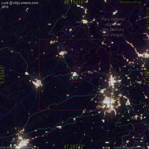
Analysis of Lure night lights 2016
Square area 10x10 km:
 1.04%
1.04%90-99
1.93%80-89
2.23%70-79
0.74%60-69
2.38%50-59
0.6%40-49
2.23%30-39
3.13%20-29
1.49%10-19
1.79%0-9
82.44%Square area 50x50 km:
0.78%90-99
0.84%80-89
0.38%70-79
0.33%60-69
0.48%50-59
0.65%40-49
0.91%30-39
1.3%20-29
1.79%10-19
3.14%0-9
89.41%Clear (daylight) street map image can be seen on geolist.org.
Map coordinates:
48° 9' 15" North, 5° 47' 36.4" East
47° 40' 58.6" North, 6° 29' 47.7" East
47° 12' 26.7" North, 7° 11' 58.9" East
Some cities around Lure sort by population:
• Belfort
27.1 km =16.8 mi,  99°
99°
• Montbéliard
29.7 km =18.5 mi,  130°
130°
• Vesoul
27.3 km =17 mi,  256°
256°
• Héricourt
23.3 km =14.5 mi,  121°
121°
• Luxeuil-les-Bains
17.9 km =11.1 mi,  326°
326°
• Bethoncourt
28.4 km =17.6 mi, 125°
• Grand-Charmont
30.2 km =18.8 mi, 125°
• Valdoie
25.9 km =16.1 mi,  93°
93°
2997076 (p: 9,415)
Sources (retrieved 2019-11-25):
» Earth at Night: Flat Maps 2012, 2016