Valdoie night lights from space
Night Light of Valdoie (Bourgogne-Franche-Comté) from space (France) Src. Average luminocity for 10x10km area is 31.9628% and for 50x50km: 11.2737%.
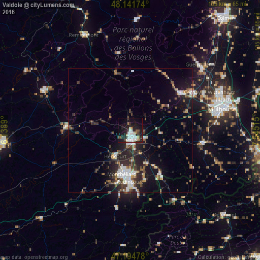
Analysis of Valdoie night lights 2016
Square area 10x10 km:
 8.78%
8.78%90-99
7.29%80-89
1.49%70-79
1.49%60-69
1.93%50-59
3.13%40-49
2.38%30-39
4.02%20-29
12.35%10-19
28.27%0-9
28.87%Square area 50x50 km:
1.73%90-99
1.9%80-89
0.92%70-79
0.88%60-69
0.96%50-59
1.43%40-49
1.88%30-39
2.27%20-29
4.41%10-19
7.91%0-9
75.72%Clear (daylight) street map image can be seen on geolist.org.
Map coordinates:
48° 8' 30.3" North, 6° 8' 20" East
47° 40' 13.5" North, 6° 50' 31.3" East
47° 11' 41.2" North, 7° 32' 42.5" East
Some cities around Valdoie sort by population:
• Belfort
3.3 km =2.1 mi,  164°
164°
• Montbéliard
18.2 km =11.3 mi,  190°
190°
• Audincourt
20.8 km =12.9 mi,  177°
177°
• Héricourt
12.4 km =7.7 mi,  209°
209°
• Bethoncourt
15.3 km =9.5 mi, 190°
• Delle
21.6 km =13.4 mi,  146°
146°
• Beaucourt
21.1 km =13.1 mi, 163°
• Grand-Charmont
16 km =9.9 mi, 184°
2971072 (p: 5,063)
Sources (retrieved 2019-11-25):
» Earth at Night: Flat Maps 2012, 2016