Luçon night lights from space
Night Light of Luçon (Pays de la Loire) from space (France) Src. Average luminocity for 10x10km area is 4.8304% and for 50x50km: 2.2627%.
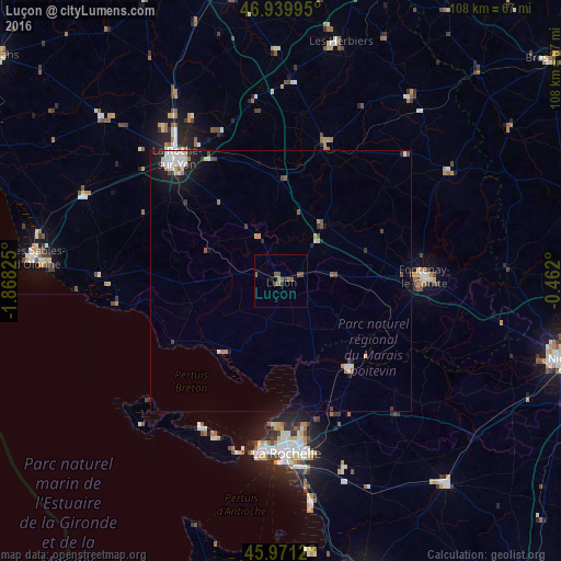
Analysis of Luçon night lights 2016
Square area 10x10 km:
 0%
0%90-99
0%80-89
0%70-79
0%60-69
1.34%50-59
3.57%40-49
1.64%30-39
0.3%20-29
1.04%10-19
0.89%0-9
91.22%Square area 50x50 km:
0.4%90-99
0.41%80-89
0.15%70-79
0.18%60-69
0.19%50-59
0.36%40-49
0.34%30-39
0.22%20-29
0.37%10-19
1.59%0-9
95.77%Clear (daylight) street map image can be seen on geolist.org.
Map coordinates:
46° 56' 23.8" North, 1° 52' 5.7" West
46° 27' 27.8" North, 1° 9' 54.4" West
45° 58' 16.3" North, 0° 27' 43.2" West
Some cities around Luçon sort by population:
• La Rochelle
32.4 km =20.1 mi,  177°
177°
• La Roche-sur-Yon
31 km =19.3 mi,  318°
318°
• Fontenay-le-Comte
27.5 km =17.1 mi,  87°
87°
• Chantonnay
27 km =16.8 mi,  19°
19°
• Lagord
30 km =18.6 mi, 178°
• Nieul-sur-Mer
28 km =17.4 mi, 179°
• Saint-Hilaire-de-Talmont
33.6 km =20.9 mi,  272°
272°
• Dompierre-sur-Mer
31 km =19.3 mi,  165°
165°
2997210 (p: 10,140)
Sources (retrieved 2019-11-25):
» Earth at Night: Flat Maps 2012, 2016