Lezoux night lights from space
Night Light of Lezoux (Auvergne-Rhône-Alpes) from space (France) Src. Average luminocity for 10x10km area is 2.314% and for 50x50km: 8.4263%.
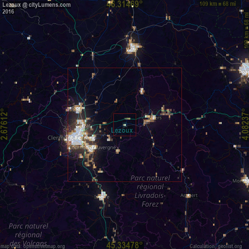
Analysis of Lezoux night lights 2016
Square area 10x10 km:
 0%
0%90-99
0.45%80-89
0.15%70-79
0%60-69
0.6%50-59
1.19%40-49
0%30-39
0.89%20-29
0.3%10-19
0%0-9
96.43%Square area 50x50 km:
1.35%90-99
1.62%80-89
0.68%70-79
0.77%60-69
0.98%50-59
1.34%40-49
1.17%30-39
1.5%20-29
2.69%10-19
4.12%0-9
83.78%Clear (daylight) street map image can be seen on geolist.org.
Map coordinates:
46° 18' 52.9" North, 2° 40' 34" East
45° 49' 36.8" North, 3° 22' 45.3" East
45° 20' 5.2" North, 4° 4' 56.5" East
Some cities around Lezoux sort by population:
• Riom
21.9 km =13.6 mi,  289°
289°
• Cournon-d’Auvergne
17.1 km =10.6 mi,  236°
236°
• Thiers
13.4 km =8.3 mi,  75°
75°
• Aubière
22.5 km =14 mi,  247°
247°
• Pont-du-Château
10.6 km =6.6 mi, 252°
• Gerzat
18.2 km =11.3 mi,  269°
269°
• Cébazat
21.6 km =13.4 mi, 271°
• Le Cendre
18.9 km =11.7 mi,  232°
232°
2998639 (p: 5,170)
Sources (retrieved 2019-11-25):
» Earth at Night: Flat Maps 2012, 2016