Gerzat night lights from space
Night Light of Gerzat (Auvergne-Rhône-Alpes) from space (France) Src. Average luminocity for 10x10km area is 48.6682% and for 50x50km: 7.8433%.
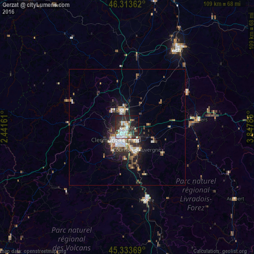
Analysis of Gerzat night lights 2016
Square area 10x10 km:
 11.76%
90-99
13.24%80-89
3.72%70-79
3.13%60-69
3.27%50-59
5.65%40-49
3.42%30-39
9.38%20-29
24.4%10-19
16.37%0-9
5.65%Square area 50x50 km:
1.36%90-99
1.58%80-89
0.61%70-79
0.59%60-69
0.89%50-59
1.16%40-49
0.99%30-39
1.27%20-29
2.62%10-19
4.69%0-9
84.22%Clear (daylight) street map image can be seen on geolist.org.
Map coordinates:
46° 18' 49" North, 2° 26' 29.8" East
45° 49' 32.9" North, 3° 8' 41" East
45° 20' 1.3" North, 3° 50' 52.3" East
Some cities around Gerzat sort by population:
• Clermont-Ferrand
6.8 km =4.2 mi,  221°
221°
• Chamalières
8.4 km =5.2 mi,  226°
226°
• Riom
7.9 km =4.9 mi,  341°
341°
• Cournon-d’Auvergne
10.2 km =6.3 mi,  156°
156°
• Beaumont
9.5 km =5.9 mi,  210°
210°
• Aubière
8.7 km =5.4 mi,  197°
197°
• Pont-du-Château
8.6 km =5.3 mi,  110°
110°
• Cébazat
3.5 km =2.2 mi,  280°
280°
3016177 (p: 9,382)
Sources (retrieved 2019-11-25):
» Earth at Night: Flat Maps 2012, 2016