Le Cendre night lights from space
Night Light of Le Cendre (Auvergne-Rhône-Alpes) from space (France) Src. Average luminocity for 10x10km area is 38.5879% and for 50x50km: 8.4403%.
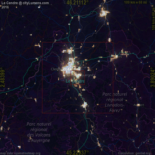
Analysis of Le Cendre night lights 2016
Square area 10x10 km:
 5.45%
5.45%90-99
6.52%80-89
4.39%70-79
5%60-69
4.24%50-59
6.36%40-49
5.76%30-39
8.48%20-29
13.03%10-19
26.82%0-9
13.94%Square area 50x50 km:
1.47%90-99
1.72%80-89
0.66%70-79
0.61%60-69
0.9%50-59
1.21%40-49
1.09%30-39
1.33%20-29
2.65%10-19
5.07%0-9
83.29%Clear (daylight) street map image can be seen on geolist.org.
Map coordinates:
46° 12' 40" North, 2° 29' 2.4" East
45° 43' 20.6" North, 3° 11' 13.6" East
45° 13' 45.7" North, 3° 53' 24.9" East
Some cities around Le Cendre sort by population:
• Clermont-Ferrand
10.1 km =6.3 mi,  309°
309°
• Chamalières
10.9 km =6.8 mi,  301°
301°
• Cournon-d’Auvergne
2.2 km =1.4 mi,  19°
19°
• Beaumont
8.7 km =5.4 mi,  291°
291°
• Aubière
6.7 km =4.2 mi, 298°
• Pont-du-Château
9.7 km =6 mi,  29°
29°
• Romagnat
6.8 km =4.2 mi,  276°
276°
• Ceyrat
9.7 km =6 mi, 276°
3004811 (p: 5,072)
Sources (retrieved 2019-11-25):
» Earth at Night: Flat Maps 2012, 2016