Houplines night lights from space
Night Light of Houplines (Hauts-de-France) from space (France) Src. Average luminocity for 10x10km area is 53.5294% and for 50x50km: 42.4999%.
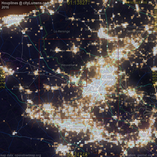
Analysis of Houplines night lights 2016
Square area 10x10 km:
 9.09%
9.09%90-99
10.03%80-89
5.61%70-79
7.75%60-69
6.68%50-59
8.56%40-49
9.89%30-39
12.57%20-29
23.8%10-19
6.02%0-9
0%Square area 50x50 km:
10.53%90-99
8.21%80-89
3.75%70-79
5.09%60-69
5.81%50-59
6.01%40-49
6.28%30-39
6.47%20-29
8.39%10-19
15.42%0-9
24.04%Clear (daylight) street map image can be seen on geolist.org.
Map coordinates:
51° 8' 17.8" North, 2° 12' 43.4" East
50° 41' 42" North, 2° 54' 54.6" East
50° 14' 50.9" North, 3° 37' 5.9" East
Some cities around Houplines sort by population:
• Lomme
7.6 km =4.7 mi,  138°
138°
• Lambersart
9.7 km =6 mi,  120°
120°
• Armentières
2.5 km =1.6 mi,  246°
246°
• Comines
10 km =6.2 mi,  42°
42°
• Wambrechies
9.4 km =5.8 mi,  98°
98°
• Pérenchies
4.8 km =3 mi,  125°
125°
• Nieppe
5.7 km =3.5 mi,  280°
280°
• Quesnoy-sur-Deûle
6.3 km =3.9 mi,  70°
70°
3013082 (p: 8,119)
Sources (retrieved 2019-11-25):
» Earth at Night: Flat Maps 2012, 2016