Gaillac night lights from space
Night Light of Gaillac (Occitanie) from space (France) Src. Average luminocity for 10x10km area is 12.1% and for 50x50km: 5.1501%.
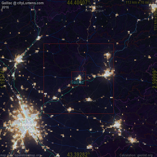
Analysis of Gaillac night lights 2016
Square area 10x10 km:
 1.11%
1.11%90-99
1.43%80-89
3.33%70-79
2.7%60-69
0.32%50-59
0.63%40-49
0.63%30-39
0.79%20-29
2.06%10-19
1.43%0-9
85.56%Square area 50x50 km:
0.39%90-99
0.69%80-89
0.64%70-79
0.54%60-69
0.73%50-59
0.82%40-49
0.93%30-39
0.79%20-29
1.16%10-19
2.78%0-9
90.53%Clear (daylight) street map image can be seen on geolist.org.
Map coordinates:
44° 24' 21.9" North, 1° 11' 37.5" East
43° 54' 5.8" North, 1° 53' 48.7" East
43° 23' 34.2" North, 2° 35' 60" East
Some cities around Gaillac sort by population:
• Albi
20.4 km =12.7 mi,  81°
81°
• Graulhet
16.7 km =10.4 mi,  153°
153°
• Carmaux
26.7 km =16.6 mi,  51°
51°
• Lavaur
23.4 km =14.5 mi,  195°
195°
• Saint-Juéry
26.2 km =16.3 mi, 78°
• Saint-Sulpice-la-Pointe
22.1 km =13.7 mi,  230°
230°
• Caussade
40.6 km =25.2 mi,  315°
315°
• Villemur-sur-Tarn
31.8 km =19.8 mi,  263°
263°
3016824 (p: 12,600)
Sources (retrieved 2019-11-25):
» Earth at Night: Flat Maps 2012, 2016