Dugny night lights from space
Night Light of Dugny (Île-de-France) from space (France) Src. Average luminocity for 10x10km area is 97.0384% and for 50x50km: 66.095%.
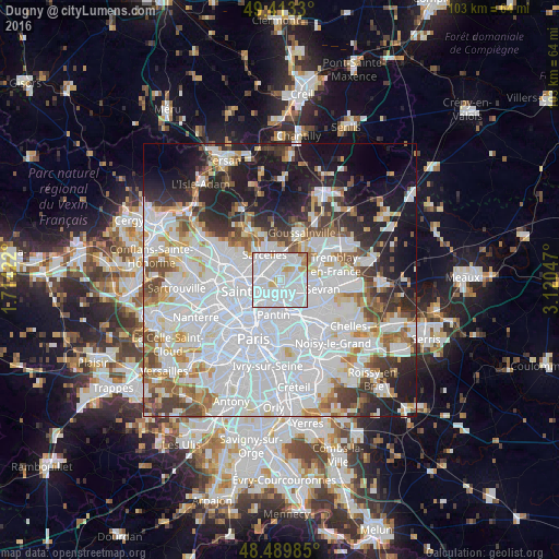
Analysis of Dugny night lights 2016
Square area 10x10 km:
 65.77%
90-99
23.15%80-89
4.83%70-79
3.84%60-69
2.41%50-59
0%40-49
0%30-39
0%20-29
0%10-19
0%0-9
0%Square area 50x50 km:
31.53%90-99
15.27%80-89
4.35%70-79
4.24%60-69
4.93%50-59
4.43%40-49
4.42%30-39
4.76%20-29
6.85%10-19
11.99%0-9
7.24%Clear (daylight) street map image can be seen on geolist.org.
Map coordinates:
49° 24' 47.9" North, 1° 42' 51.2" East
48° 57' 13.4" North, 2° 25' 2.4" East
48° 29' 23.5" North, 3° 7' 13.7" East
Some cities around Dugny sort by population:
• Drancy
3.7 km =2.3 mi,  146°
146°
• Le Blanc-Mesnil
3.6 km =2.2 mi,  117°
117°
• Garges-lès-Gonesse
2.1 km =1.3 mi,  317°
317°
• La Courneuve
3.2 km =2 mi,  208°
208°
• Stains
2.5 km =1.6 mi,  260°
260°
• Gonesse
4.4 km =2.7 mi,  31°
31°
• Arnouville
3.3 km =2.1 mi,  359°
359°
• Le Bourget
2.6 km =1.6 mi, 148°
3020712 (p: 10,709)
Sources (retrieved 2019-11-25):
» Earth at Night: Flat Maps 2012, 2016