Douvrin night lights from space
Night Light of Douvrin (Hauts-de-France) from space (France) Src. Average luminocity for 10x10km area is 69.3571% and for 50x50km: 47.0951%.
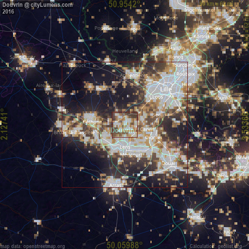
Analysis of Douvrin night lights 2016
Square area 10x10 km:
 12.89%
90-99
17.93%80-89
8.4%70-79
9.1%60-69
12.89%50-59
10.22%40-49
15.83%30-39
12.32%20-29
0.42%10-19
0%0-9
0%Square area 50x50 km:
12.43%90-99
10.74%80-89
4.07%70-79
4.91%60-69
5.64%50-59
5.36%40-49
6.02%30-39
7.44%20-29
10.81%10-19
16.01%0-9
16.55%Clear (daylight) street map image can be seen on geolist.org.
Map coordinates:
50° 57' 15.1" North, 2° 7' 38.7" East
50° 30' 33" North, 2° 49' 49.9" East
50° 3' 35.6" North, 3° 32' 1.2" East
Some cities around Douvrin sort by population:
• Annoeullin
7.5 km =4.7 mi,  72°
72°
• Wingles
2.4 km =1.5 mi,  134°
134°
• Loos-en-Gohelle
6.3 km =3.9 mi,  205°
205°
• Vendin-le-Vieil
4.7 km =2.9 mi,  146°
146°
• La Bassée
3.3 km =2.1 mi,  328°
328°
• Loison-sous-Lens
8.1 km =5 mi,  168°
168°
• Sainghin-en-Weppes
7.7 km =4.8 mi,  38°
38°
• Bauvin
4.6 km =2.9 mi,  78°
78°
3020886 (p: 5,199)
Sources (retrieved 2019-11-25):
» Earth at Night: Flat Maps 2012, 2016