Bauvin night lights from space
Night Light of Bauvin (Hauts-de-France) from space (France) Src. Average luminocity for 10x10km area is 71.2101% and for 50x50km: 49.7548%.
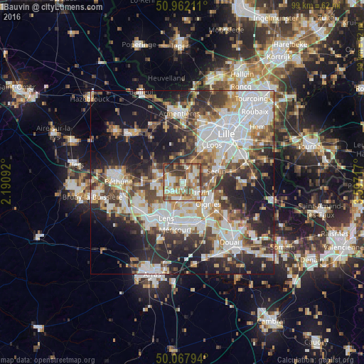
Analysis of Bauvin night lights 2016
Square area 10x10 km:
 12.46%
90-99
19.89%80-89
7.7%70-79
13.17%60-69
13.31%50-59
11.2%40-49
10.08%30-39
10.36%20-29
1.82%10-19
0%0-9
0%Square area 50x50 km:
13.51%90-99
11.19%80-89
4.22%70-79
5.19%60-69
5.9%50-59
5.61%40-49
6.41%30-39
7.79%20-29
11.55%10-19
17.23%0-9
11.42%Clear (daylight) street map image can be seen on geolist.org.
Map coordinates:
50° 57' 43.6" North, 2° 11' 27.3" East
50° 31' 1.7" North, 2° 53' 38.5" East
50° 4' 4.6" North, 3° 35' 49.8" East
Some cities around Bauvin sort by population:
• Carvin
5.3 km =3.3 mi,  121°
121°
• Annoeullin
3 km =1.9 mi,  63°
63°
• Wingles
3.8 km =2.4 mi,  226°
226°
• Wavrin
7 km =4.3 mi,  25°
25°
• Vendin-le-Vieil
5.2 km =3.2 mi,  201°
201°
• La Bassée
6.5 km =4 mi,  287°
287°
• Sainghin-en-Weppes
5.2 km =3.2 mi,  3°
3°
• Douvrin
4.6 km =2.9 mi,  258°
258°
3034521 (p: 5,426)
Sources (retrieved 2019-11-25):
» Earth at Night: Flat Maps 2012, 2016