Douchy-les-Mines night lights from space
Night Light of Douchy-les-Mines (Hauts-de-France) from space (France) Src. Average luminocity for 10x10km area is 48.5548% and for 50x50km: 26.8347%.
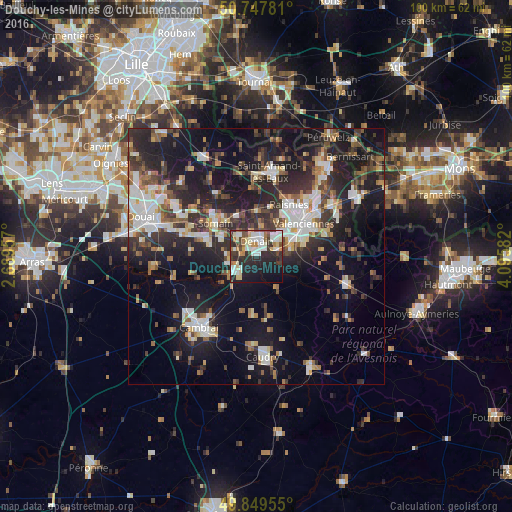
Analysis of Douchy-les-Mines night lights 2016
Square area 10x10 km:
 10.29%
90-99
13.1%80-89
6.02%70-79
3.88%60-69
5.21%50-59
1.6%40-49
6.42%30-39
6.95%20-29
20.05%10-19
19.65%0-9
6.82%Square area 50x50 km:
4.03%90-99
5.1%80-89
2.37%70-79
2.16%60-69
3.28%50-59
3.35%40-49
3.94%30-39
5.09%20-29
10.68%10-19
20.9%0-9
39.1%Clear (daylight) street map image can be seen on geolist.org.
Map coordinates:
50° 44' 52.1" North, 2° 41' 22.5" East
50° 18' 2.9" North, 3° 23' 33.7" East
49° 50' 58.4" North, 4° 5' 45" East
Some cities around Douchy-les-Mines sort by population:
• Denain
3.2 km =2 mi,  2°
2°
• Somain
10.3 km =6.4 mi,  309°
309°
• Aniche
10.4 km =6.5 mi,  288°
288°
• Escaudain
5 km =3.1 mi,  316°
316°
• Trith-Saint-Léger
6.7 km =4.2 mi,  74°
74°
• Wallers
8.2 km =5.1 mi,  359°
359°
• Fenain
9.8 km =6.1 mi, 318°
• Petite-Forêt
9.7 km =6 mi,  41°
41°
3020980 (p: 10,296)
Sources (retrieved 2019-11-25):
» Earth at Night: Flat Maps 2012, 2016