Mouvaux night lights from space
Night Light of Mouvaux (Hauts-de-France) from space (France) Src. Average luminocity for 10x10km area is 94.1805% and for 50x50km: 46.6376%.
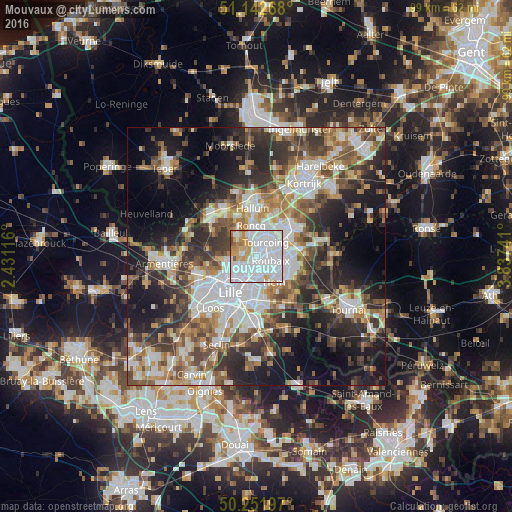
Analysis of Mouvaux night lights 2016
Square area 10x10 km:
 64.84%
90-99
15.37%80-89
4.81%70-79
9.09%60-69
3.88%50-59
1.07%40-49
0.94%30-39
0%20-29
0%10-19
0%0-9
0%Square area 50x50 km:
10.95%90-99
8.76%80-89
4.21%70-79
5.45%60-69
6.56%50-59
7.2%40-49
7.15%30-39
7.59%20-29
11.44%10-19
15.8%0-9
14.89%Clear (daylight) street map image can be seen on geolist.org.
Map coordinates:
51° 8' 33.6" North, 2° 25' 52.2" East
50° 41' 58" North, 3° 8' 3.4" East
50° 15' 7.1" North, 3° 50' 14.7" East
Some cities around Mouvaux sort by population:
• Roubaix
2.9 km =1.8 mi,  101°
101°
• Tourcoing
3.3 km =2.1 mi,  34°
34°
• Marcq-en-Barœul
5.1 km =3.2 mi,  224°
224°
• Croix
2.6 km =1.6 mi,  155°
155°
• Wasquehal
3.2 km =2 mi,  180°
180°
• Bondues
2.8 km =1.7 mi,  275°
275°
• Marquette-lez-Lille
5.4 km =3.4 mi,  241°
241°
• Neuville-en-Ferrain
5.7 km =3.5 mi,  16°
16°
2991302 (p: 13,285)
Sources (retrieved 2019-11-25):
» Earth at Night: Flat Maps 2012, 2016