Cergy night lights from space
Night Light of Cergy (Île-de-France) from space (France) Src. Average luminocity for 10x10km area is 86.2113% and for 50x50km: 44.3219%.
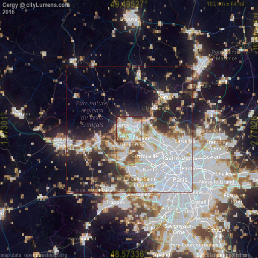
Analysis of Cergy night lights 2016
Square area 10x10 km:
 31.99%
90-99
29.61%80-89
7.44%70-79
12.95%60-69
7.89%50-59
2.08%40-49
3.27%30-39
4.17%20-29
0.6%10-19
0%0-9
0%Square area 50x50 km:
17.53%90-99
9.12%80-89
3.32%70-79
3.47%60-69
3.87%50-59
3.6%40-49
4.68%30-39
3.99%20-29
7.96%10-19
13.28%0-9
29.18%Clear (daylight) street map image can be seen on geolist.org.
Map coordinates:
49° 29' 43" North, 1° 22' 22.8" East
49° 2' 11.2" North, 2° 4' 34.1" East
48° 34' 24.1" North, 2° 46' 45.3" East
Some cities around Cergy sort by population:
• Conflans-Sainte-Honorine
4.2 km =2.6 mi,  158°
158°
• Pontoise
2.3 km =1.4 mi,  49°
49°
• Saint-Ouen-l’Aumône
3.4 km =2.1 mi,  76°
76°
• Vauréal
3.1 km =1.9 mi,  263°
263°
• Jouy-le-Moutier
3.9 km =2.4 mi,  222°
222°
• Osny
3.9 km =2.4 mi,  345°
345°
• Éragny
2.8 km =1.7 mi,  141°
141°
• Courdimanche
5.5 km =3.4 mi,  268°
268°
3027883 (p: 57,576)
Sources (retrieved 2019-11-25):
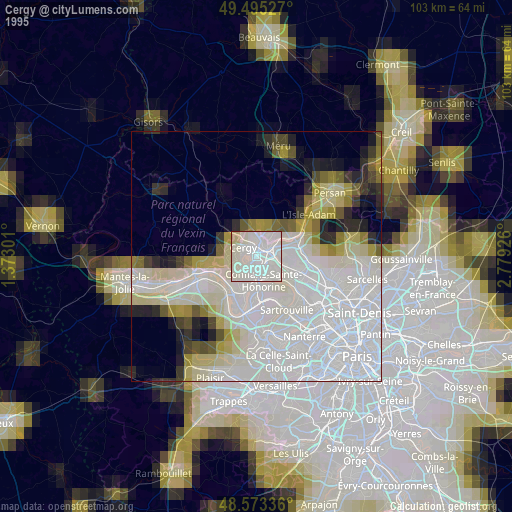
» NASA, Earths city lights 1995
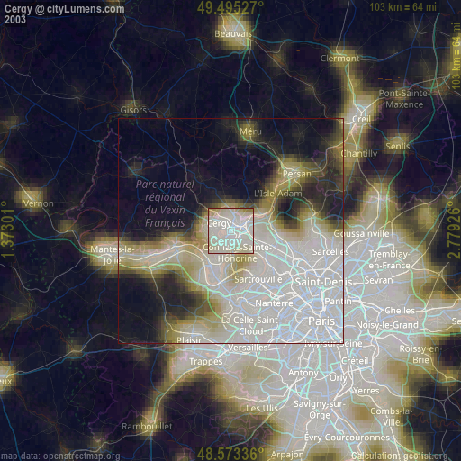
» NASA city lights 2003
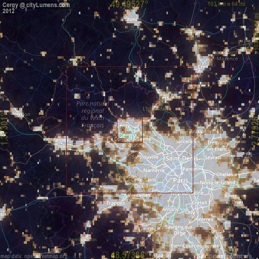
» Earth at Night: Flat Maps 2012, 2016