Saint-Ouen-l’Aumône night lights from space
Night Light of Saint-Ouen-l’Aumône (Île-de-France) from space (France) Src. Average luminocity for 10x10km area is 80.4911% and for 50x50km: 46.2465%.
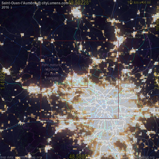

Analysis of Saint-Ouen-l’Aumône night lights 2016
Square area 10x10 km:
 28.13%
90-99
24.55%80-89
8.18%70-79
13.84%60-69
6.1%50-59
3.57%40-49
3.27%30-39
6.85%20-29
5.51%10-19
0%0-9
0%Square area 50x50 km:
18.54%90-99
9.72%80-89
3.49%70-79
3.62%60-69
3.68%50-59
3.66%40-49
4.9%30-39
4.19%20-29
8%10-19
13.63%0-9
26.57%Clear (daylight) street map image can be seen on geolist.org.
Map coordinates:
49° 30' 8.2" North, 1° 25' 5.6" East
49° 2' 36.7" North, 2° 7' 16.8" East
48° 34' 49.8" North, 2° 49' 28.1" East
Some cities around Saint-Ouen-l’Aumône sort by population:
• Cergy-Pontoise
3.2 km =2 mi,  260°
260°
• Cergy
3.4 km =2.1 mi, 256°
• Conflans-Sainte-Honorine
5 km =3.1 mi,  200°
200°
• Pontoise
1.7 km =1.1 mi,  294°
294°
• Osny
5.2 km =3.2 mi,  304°
304°
• Éragny
3.4 km =2.1 mi,  207°
207°
• Pierrelaye
3.5 km =2.2 mi,  135°
135°
• Auvers-sur-Oise
4.7 km =2.9 mi,  48°
48°
2977800 (p: 22,977)
Sources (retrieved 2019-11-25):
» Earth at Night: Flat Maps 2012, 2016