Achères night lights from space
Night Light of Achères (Île-de-France) from space (France) Src. Average luminocity for 10x10km area is 76.1463% and for 50x50km: 52.948%.
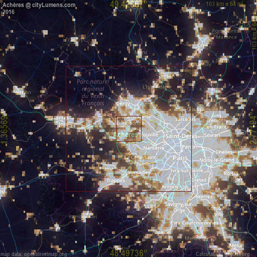
Analysis of Achères night lights 2016
Square area 10x10 km:
 16.9%
16.9%90-99
20.74%80-89
11.22%70-79
9.38%60-69
12.64%50-59
12.5%40-49
16.62%30-39
0%20-29
0%10-19
0%0-9
0%Square area 50x50 km:
21.53%90-99
11.82%80-89
4.09%70-79
3.99%60-69
4.77%50-59
4.34%40-49
5.13%30-39
4.7%20-29
7.97%10-19
11.61%0-9
20.05%Clear (daylight) street map image can be seen on geolist.org.
Map coordinates:
49° 25' 14.4" North, 1° 21' 56.5" East
48° 57' 40.1" North, 2° 4' 7.8" East
48° 29' 50.5" North, 2° 46' 19" East
Some cities around Achères sort by population:
• Poissy
3.8 km =2.4 mi,  201°
201°
• Conflans-Sainte-Honorine
4.9 km =3 mi,  24°
24°
• Maisons-Laffitte
5.7 km =3.5 mi,  99°
99°
• Carrières-sous-Poissy
2.4 km =1.5 mi,  237°
237°
• Andrésy
2.5 km =1.6 mi,  339°
339°
• Triel-sur-Seine
4.9 km =3 mi,  292°
292°
• Chanteloup-les-Vignes
3.1 km =1.9 mi,  302°
302°
• Le Mesnil-le-Roi
4.9 km =3 mi,  121°
121°
3038712 (p: 22,555)
Sources (retrieved 2019-11-25):
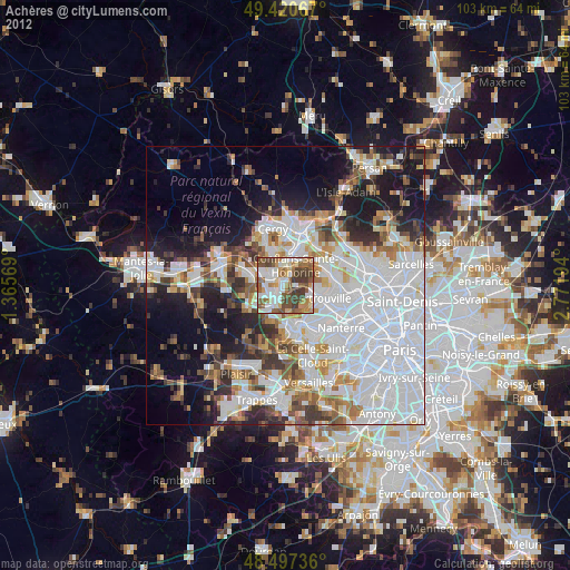
» Earth at Night: Flat Maps 2012, 2016