Carrières-sous-Poissy night lights from space
Night Light of Carrières-sous-Poissy (Île-de-France) from space (France) Src. Average luminocity for 10x10km area is 75.0753% and for 50x50km: 51.6813%.
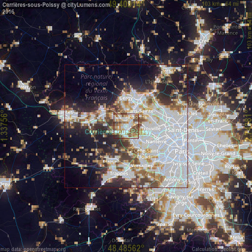
Analysis of Carrières-sous-Poissy night lights 2016
Square area 10x10 km:
 16.34%
90-99
20.45%80-89
12.5%70-79
7.81%60-69
12.5%50-59
14.35%40-49
12.36%30-39
1.99%20-29
1.7%10-19
0%0-9
0%Square area 50x50 km:
19.91%90-99
11.94%80-89
4.08%70-79
4.02%60-69
4.86%50-59
4.36%40-49
5.4%30-39
4.76%20-29
8.22%10-19
10.99%0-9
21.47%Clear (daylight) street map image can be seen on geolist.org.
Map coordinates:
49° 24' 32.9" North, 1° 20' 15.2" East
48° 56' 58.3" North, 2° 2' 26.4" East
48° 29' 8.2" North, 2° 44' 37.7" East
Some cities around Carrières-sous-Poissy sort by population:
• Poissy
2.4 km =1.5 mi,  164°
164°
• Achères
2.4 km =1.5 mi,  57°
57°
• Andrésy
3.8 km =2.4 mi,  17°
17°
• Triel-sur-Seine
4 km =2.5 mi,  322°
322°
• Vernouillet
5 km =3.1 mi,  299°
299°
• Chanteloup-les-Vignes
3 km =1.9 mi,  348°
348°
• Chambourcy
4.8 km =3 mi,  179°
179°
• Villennes-sur-Seine
3.7 km =2.3 mi,  255°
255°
3028521 (p: 15,465)
Sources (retrieved 2019-11-25):
» Earth at Night: Flat Maps 2012, 2016