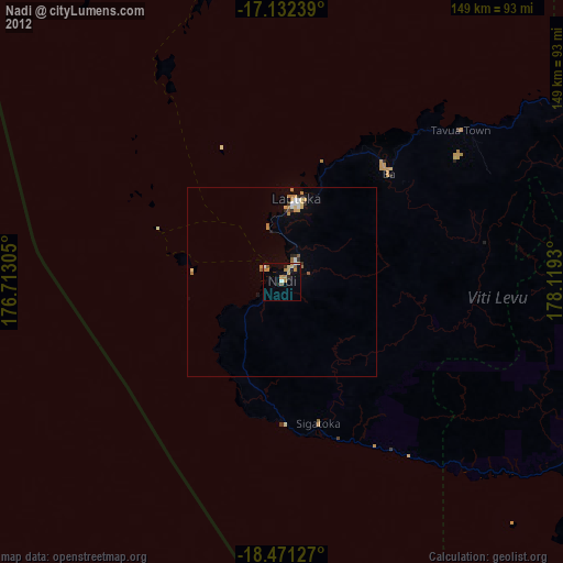
Nadi night lights from space
Night Light of Nadi (Western) from space (Fiji) Src. Average luminocity for 10x10km area is 19.5476% and for 50x50km: 2.1655%.
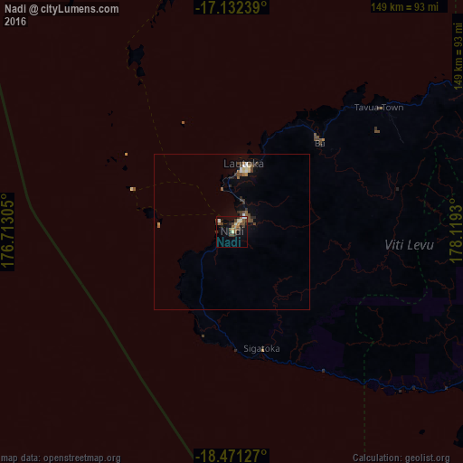
Analysis of Nadi night lights 2016
Square area 10x10 km:
 0.87%
0.87%90-99
1.73%80-89
3.03%70-79
2.6%60-69
2.6%50-59
3.03%40-49
6.06%30-39
5.63%20-29
3.9%10-19
9.09%0-9
61.47%Square area 50x50 km:
0.16%90-99
0.2%80-89
0.3%70-79
0.16%60-69
0.2%50-59
0.31%40-49
0.57%30-39
0.64%20-29
0.44%10-19
0.75%0-9
96.25%Clear (daylight) street map image can be seen on geolist.org.
Map coordinates:
17° 7' 56.6" South, 176° 42' 47" East
17° 48' 11.1" South, 177° 24' 58.2" East
18° 28' 16.6" South, 178° 7' 9.5" East
Some cities around Nadi sort by population:
• Suva
114.8 km =71.3 mi,  109°
109°
• Lautoka
21 km =13 mi,  9°
9°
• Port-Vila, VU
963.8 km =598.9 mi,  270°
270°
• Labasa
257 km =159.7 mi,  53°
53°
• Ba
40.5 km =25.2 mi,  42°
42°
• Levuka
203.2 km =126.3 mi,  98°
98°
• Isangel, VU
878.3 km =545.8 mi,  257°
257°
• Ahau
591 km =367.2 mi,  356°
356°
2202064 (p: 42,284)
Sources (retrieved 2019-11-25):
» Earth at Night: Flat Maps 2012, 2016