Pori night lights from space
Night Light of Pori (Satakunta) from space (Finland) Src. Average luminocity for 10x10km area is 58.177% and for 50x50km: 5.6526%.
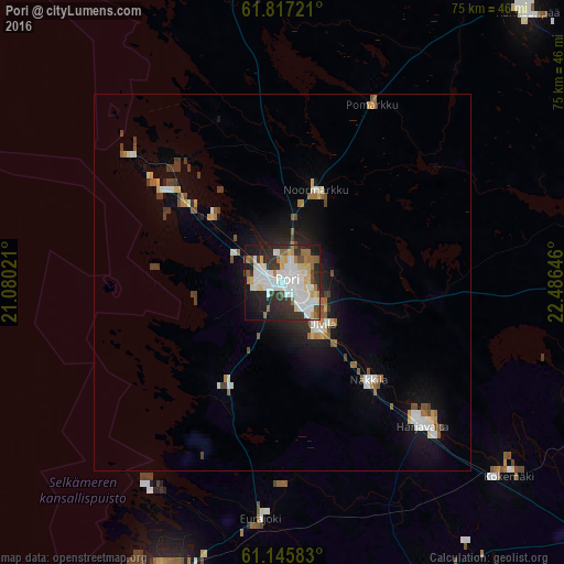
Analysis of Pori night lights 2016
Square area 10x10 km:
 17.39%
90-99
16.56%80-89
6.21%70-79
3.73%60-69
5.8%50-59
4.14%40-49
3.93%30-39
7.04%20-29
17.7%10-19
15.11%0-9
2.38%Square area 50x50 km:
1.03%90-99
1.09%80-89
0.46%70-79
0.49%60-69
0.67%50-59
0.6%40-49
0.69%30-39
0.75%20-29
1.21%10-19
3.57%0-9
89.44%Clear (daylight) street map image can be seen on geolist.org.
Map coordinates:
61° 49' 2" North, 21° 4' 48.8" East
61° 28' 60" North, 21° 46' 60" East
61° 8' 45" North, 22° 29' 11.3" East
Some cities around Pori sort by population:
• Rauma
42.2 km =26.2 mi,  200°
200°
• Ulvila
7.7 km =4.8 mi,  142°
142°
• Eura
43.2 km =26.8 mi,  154°
154°
• Kokemäki
39.6 km =24.6 mi,  129°
129°
• Harjavalta
26.3 km =16.3 mi, 134°
• Noormarkku
13 km =8.1 mi,  20°
20°
• Nakkila
17.4 km =10.8 mi, 138°
• Eurajoki
31.6 km =19.6 mi,  184°
184°
640999 (p: 76,772)
Sources (retrieved 2019-11-25):
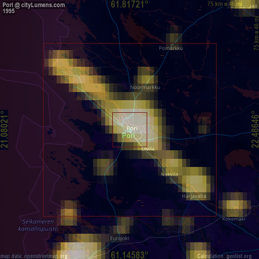
» NASA, Earths city lights 1995
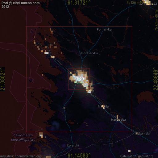
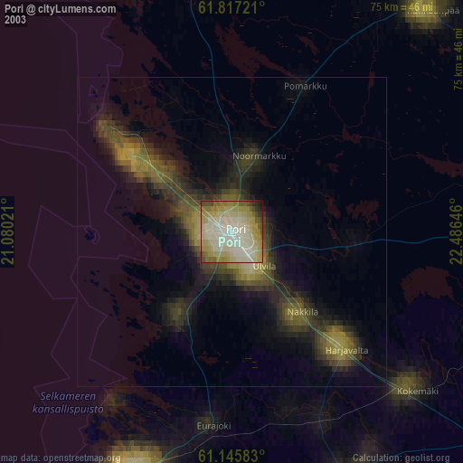
» NASA city lights 2003
» Earth at Night: Flat Maps 2012, 2016