Nakkila night lights from space
Night Light of Nakkila (Satakunta) from space (Finland) Src. Average luminocity for 10x10km area is 8.1443% and for 50x50km: 5.6681%.
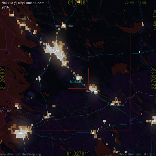
Analysis of Nakkila night lights 2016
Square area 10x10 km:
 1.38%
1.38%90-99
0.99%80-89
0%70-79
0.4%60-69
1.38%50-59
3.16%40-49
0.49%30-39
0.1%20-29
0%10-19
0.69%0-9
91.4%Square area 50x50 km:
1.06%90-99
1.08%80-89
0.43%70-79
0.46%60-69
0.79%50-59
0.7%40-49
0.75%30-39
0.45%20-29
1.23%10-19
3.62%0-9
89.44%Clear (daylight) street map image can be seen on geolist.org.
Map coordinates:
61° 42' 6.5" North, 21° 17' 48.8" East
61° 22' 0" North, 22° 0' 0" East
61° 1' 40.5" North, 22° 42' 11.3" East
Some cities around Nakkila sort by population:
• Pori
17.4 km =10.8 mi,  318°
318°
• Rauma
37.3 km =23.2 mi,  224°
224°
• Ulvila
9.7 km =6 mi, 315°
• Eura
26.9 km =16.7 mi,  164°
164°
• Kokemäki
22.6 km =14 mi,  122°
122°
• Harjavalta
9 km =5.6 mi,  128°
128°
• Noormarkku
26.1 km =16.2 mi,  344°
344°
• Eurajoki
23.4 km =14.5 mi, 217°
645148 (p: 5,792)
Sources (retrieved 2019-11-25):
» Earth at Night: Flat Maps 2012, 2016