Eura night lights from space
Night Light of Eura (Satakunta) from space (Finland) Src. Average luminocity for 10x10km area is 5.776% and for 50x50km: 1.711%.
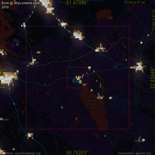
Analysis of Eura night lights 2016
Square area 10x10 km:
 0%
0%90-99
0.32%80-89
0.54%70-79
0.54%60-69
1.52%50-59
1.84%40-49
1.62%30-39
2.27%20-29
0%10-19
0%0-9
91.34%Square area 50x50 km:
0.24%90-99
0.24%80-89
0.1%70-79
0.15%60-69
0.29%50-59
0.34%40-49
0.4%30-39
0.2%20-29
0.01%10-19
0.7%0-9
97.33%Clear (daylight) street map image can be seen on geolist.org.
Map coordinates:
61° 28' 15.5" North, 21° 25' 48.8" East
61° 7' 60" North, 22° 7' 60" East
60° 47' 31.4" North, 22° 50' 11.3" East
Some cities around Eura sort by population:
• Rauma
33.4 km =20.8 mi,  268°
268°
• Ulvila
35.7 km =22.2 mi,  336°
336°
• Huittinen
30.9 km =19.2 mi,  79°
79°
• Laitila
37 km =23 mi,  219°
219°
• Kokemäki
18.2 km =11.3 mi,  41°
41°
• Harjavalta
20.4 km =12.7 mi,  0°
0°
• Nakkila
26.9 km =16.7 mi, 344°
• Eurajoki
22.7 km =14.1 mi,  289°
289°
660077 (p: 9,338)
Sources (retrieved 2019-11-25):
» Earth at Night: Flat Maps 2012, 2016