Ziway night lights from space
Night Light of Ziway (Oromiya) from space (Ethiopia) Src. Average luminocity for 10x10km area is 10.7438% and for 50x50km: 0.7326%.
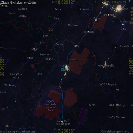
Analysis of Ziway night lights 2016
Square area 10x10 km:
 0%
0%90-99
0%80-89
2.69%70-79
3.1%60-69
0.83%50-59
1.65%40-49
4.75%30-39
1.03%20-29
1.45%10-19
0.21%0-9
84.3%Square area 50x50 km:
0%90-99
0%80-89
0.14%70-79
0.13%60-69
0.16%50-59
0.13%40-49
0.28%30-39
0.08%20-29
0.13%10-19
0.1%0-9
98.84%Clear (daylight) street map image can be seen on geolist.org.
Map coordinates:
8° 37' 44.8" North, 38° 0' 48.8" East
7° 55' 60" North, 38° 43' 0" East
7° 14' 10.9" North, 39° 25' 11.3" East
Some cities around Ziway sort by population:
• Nazrēt
91.5 km =56.9 mi,  41°
41°
• Bishoftu
95.5 km =59.3 mi,  17°
17°
• Shashemenē
82.5 km =51.3 mi,  188°
188°
• Mojo
85.2 km =52.9 mi,  31°
31°
• Butajīra
43.6 km =27.1 mi,  297°
297°
• Wenjī
84.8 km =52.7 mi,  47°
47°
• Huruta
73.8 km =45.9 mi,  70°
70°
• Sirre
94.5 km =58.7 mi,  63°
63°
325579 (p: 49,416)
Sources (retrieved 2019-11-25):
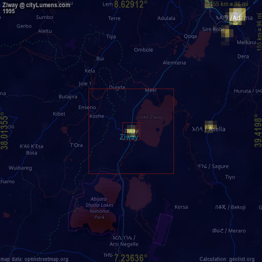
» NASA, Earths city lights 1995
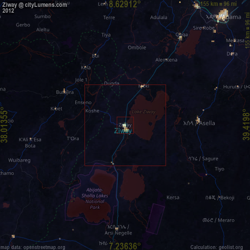
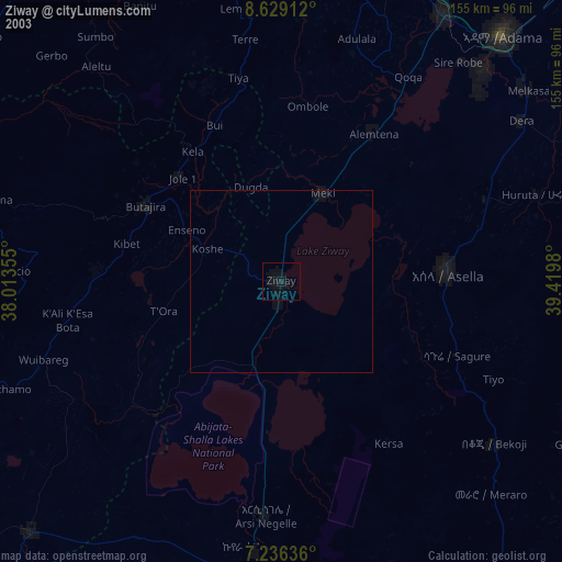
» NASA city lights 2003
» Earth at Night: Flat Maps 2012, 2016