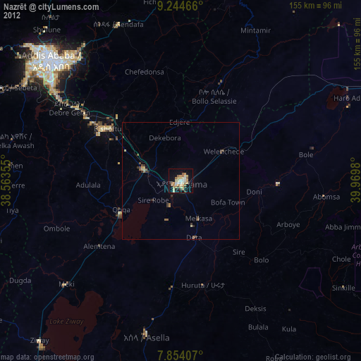
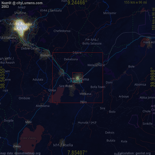
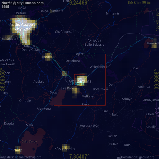
Nazrēt night lights from space
Night Light of Nazrēt (Oromiya) from space (Ethiopia) Src. Average luminocity for 10x10km area is 37.5537% and for 50x50km: 3.0198%.
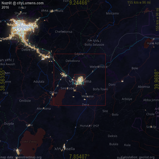
Analysis of Nazrēt night lights 2016
Square area 10x10 km:
 1.03%
1.03%90-99
2.89%80-89
14.26%70-79
7.64%60-69
4.34%50-59
3.31%40-49
6.82%30-39
4.96%20-29
4.55%10-19
35.33%0-9
14.88%Square area 50x50 km:
0.09%90-99
0.13%80-89
0.81%70-79
0.45%60-69
0.38%50-59
0.31%40-49
0.52%30-39
0.73%20-29
0.48%10-19
2.12%0-9
93.97%Clear (daylight) street map image can be seen on geolist.org.
Map coordinates:
9° 14' 40.8" North, 38° 33' 48.8" East
8° 33' 0" North, 39° 16' 0" East
7° 51' 14.7" North, 39° 58' 11.3" East
Some cities around Nazrēt sort by population:
• Addis Ababa
77.8 km =48.3 mi,  312°
312°
• Bishoftu
38.9 km =24.2 mi, 305°
• Mojo
16.5 km =10.3 mi,  284°
284°
• Metahāra
81.3 km =50.5 mi,  61°
61°
• Wenjī
11.3 km =7 mi,  170°
170°
• Huruta
45.4 km =28.2 mi, 168°
• Sirre
35.2 km =21.9 mi,  137°
137°
• Sendafa
72.1 km =44.8 mi,  338°
338°
330186 (p: 213,995)
Sources (retrieved 2019-11-25):
» NASA, Earths city lights 1995
» NASA city lights 2003
» Earth at Night: Flat Maps 2012, 2016