Mojo night lights from space
Night Light of Mojo (Oromiya) from space (Ethiopia) Src. Average luminocity for 10x10km area is 14.1674% and for 50x50km: 5.0563%.
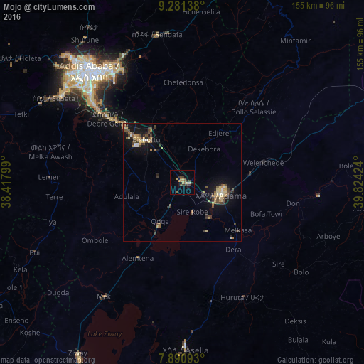
Analysis of Mojo night lights 2016
Square area 10x10 km:
100  0.62%
0.62%
90-99 0.21%
80-89 3.51%
70-79 2.07%
60-69 2.69%
50-59 2.48%
40-49 1.86%
30-39 4.96%
20-29 2.27%
10-19 0%
0-9 79.34%
0.62%90-99
0.21%80-89
3.51%70-79
2.07%60-69
2.69%50-59
2.48%40-49
1.86%30-39
4.96%20-29
2.27%10-19
0%0-9
79.34%Square area 50x50 km:
100 0.2%
90-99 0.29%
80-89 1.04%
70-79 0.84%
60-69 0.71%
50-59 0.53%
40-49 1.05%
30-39 1.2%
20-29 0.8%
10-19 4.31%
0-9 89.03%
0.2%90-99
0.29%80-89
1.04%70-79
0.84%60-69
0.71%50-59
0.53%40-49
1.05%30-39
1.2%20-29
0.8%10-19
4.31%0-9
89.03%Clear (daylight) street map image can be seen on geolist.org.
Map coordinates:
9° 16' 53" North, 38° 25' 4.8" East
8° 35' 12.4" North, 39° 7' 16" East
7° 53' 27.3" North, 39° 49' 27.3" East
Some cities around Mojo sort by population:
• Addis Ababa
63.8 km =39.6 mi,  319°
319°
• Nazrēt
16.5 km =10.3 mi,  104°
104°
• Bishoftu
24.2 km =15 mi, 319°
• Sebeta
66.5 km =41.3 mi,  303°
303°
• Wenjī
23.4 km =14.5 mi,  130°
130°
• Huruta
54.7 km =34 mi,  152°
152°
• Sirre
49.9 km =31 mi, 127°
• Sendafa
63.8 km =39.6 mi,  350°
350°
330491 (p: 34,547)
Sources (retrieved 2019-11-25):
» Earth at Night: Flat Maps 2012, 2016