Sendafa night lights from space
Night Light of Sendafa (Oromiya) from space (Ethiopia) Src. Average luminocity for 10x10km area is 4.6429% and for 50x50km: 4.1828%.
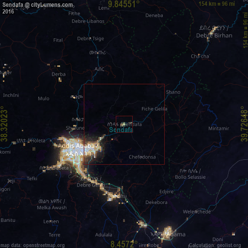
Analysis of Sendafa night lights 2016
Square area 10x10 km:
 0%
0%90-99
0%80-89
0.65%70-79
0.22%60-69
0.87%50-59
0.87%40-49
1.52%30-39
3.25%20-29
1.3%10-19
1.73%0-9
89.61%Square area 50x50 km:
0.46%90-99
0.54%80-89
0.85%70-79
0.71%60-69
0.35%50-59
0.48%40-49
0.7%30-39
0.91%20-29
1.27%10-19
2.45%0-9
91.29%Clear (daylight) street map image can be seen on geolist.org.
Map coordinates:
9° 50' 43.8" North, 38° 19' 12.8" East
9° 9' 7.3" North, 39° 1' 24.1" East
8° 27' 25.9" North, 39° 43' 35.3" East
Some cities around Sendafa sort by population:
• Addis Ababa
33.5 km =20.8 mi,  245°
245°
• Nazrēt
72.1 km =44.8 mi,  158°
158°
• Bishoftu
44.7 km =27.8 mi,  186°
186°
• Mojo
63.8 km =39.6 mi,  170°
170°
• Fichē
78.8 km =49 mi,  336°
336°
• Genet
58.2 km =36.2 mi,  260°
260°
• Sebeta
51.8 km =32.2 mi,  239°
239°
• Ādīs ‘Alem
69.7 km =43.3 mi, 259°
328880 (p: 7,326)
Sources (retrieved 2019-11-25):
» Earth at Night: Flat Maps 2012, 2016