Addis Ababa night lights from space
Night Light of Addis Ababa from space (Ethiopia) Src. Average luminocity for 10x10km area is 90.5606% and for 50x50km: 17.0593%.
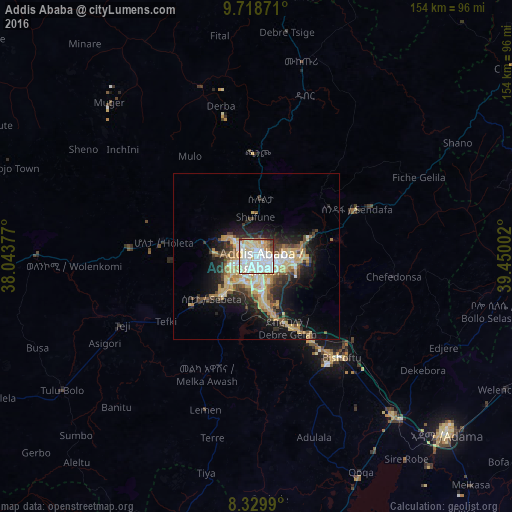
Analysis of Addis Ababa night lights 2016
Square area 10x10 km:
 32.03%
90-99
32.68%80-89
20.35%70-79
7.14%60-69
2.6%50-59
1.3%40-49
2.6%30-39
0.87%20-29
0.43%10-19
0%0-9
0%Square area 50x50 km:
2.21%90-99
2.8%80-89
3.98%70-79
3.08%60-69
1.37%50-59
1.71%40-49
2.13%30-39
2.12%20-29
4.45%10-19
8.59%0-9
67.58%Clear (daylight) street map image can be seen on geolist.org.
Map coordinates:
9° 43' 7.4" North, 38° 2' 37.6" East
9° 1' 29.9" North, 38° 44' 48.8" East
8° 19' 47.6" North, 39° 27' 0.1" East
Some cities around Addis Ababa sort by population:
• Nazrēt
77.8 km =48.3 mi,  132°
132°
• Bishoftu
39.6 km =24.6 mi,  140°
140°
• Mojo
63.8 km =39.6 mi, 139°
• Genet
27.5 km =17.1 mi,  279°
279°
• Sebeta
18.7 km =11.6 mi,  229°
229°
• Tulu Bolo
70.6 km =43.9 mi,  235°
235°
• Ādīs ‘Alem
38.1 km =23.7 mi,  271°
271°
• Sendafa
33.5 km =20.8 mi,  65°
65°
344979 (p: 2,757,729)
Sources (retrieved 2019-11-25):
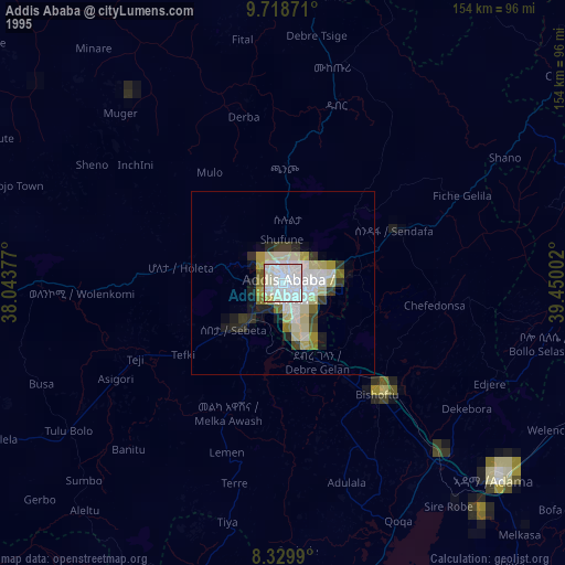
» NASA, Earths city lights 1995
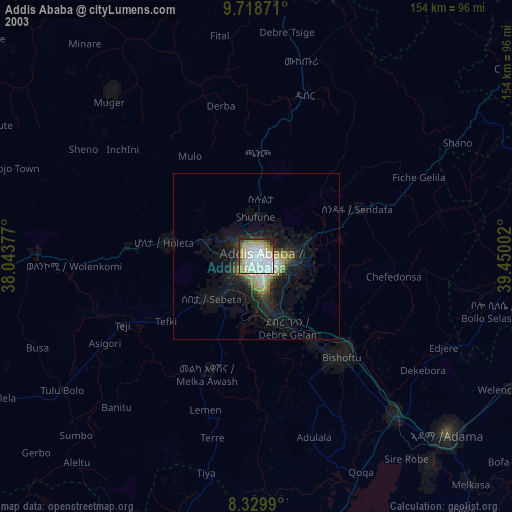
» NASA city lights 2003
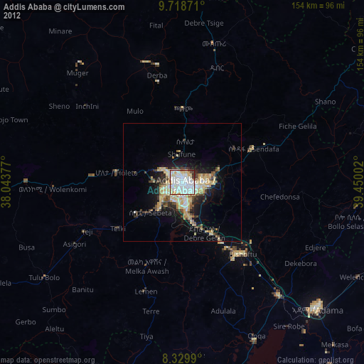
» Earth at Night: Flat Maps 2012, 2016