Vedra night lights from space
Night Light of Vedra (Galicia) from space (Spain) Src. Average luminocity for 10x10km area is 16.6818% and for 50x50km: 12.3731%.
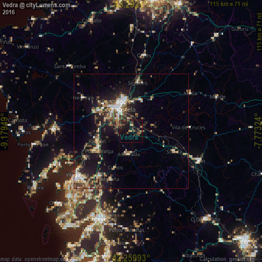
Analysis of Vedra night lights 2016
Square area 10x10 km:
 0%
0%90-99
0%80-89
1.21%70-79
1.97%60-69
1.67%50-59
3.64%40-49
4.85%30-39
6.21%20-29
6.06%10-19
19.55%0-9
54.85%Square area 50x50 km:
1.1%90-99
1.92%80-89
1.01%70-79
1.24%60-69
1.7%50-59
2.01%40-49
2.25%30-39
2.68%20-29
4.58%10-19
10.28%0-9
71.23%Clear (daylight) street map image can be seen on geolist.org.
Map coordinates:
43° 17' 31.6" North, 9° 10' 46.2" West
42° 46' 41.4" North, 8° 28' 34.9" West
42° 15' 35.7" North, 7° 46' 23.7" West
Some cities around Vedra sort by population:
• Santiago de Compostela
12.7 km =7.9 mi,  333°
333°
• Ribeira
4.4 km =2.7 mi,  143°
143°
• Amés
20.2 km =12.6 mi,  313°
313°
• A Estrada
10 km =6.2 mi,  185°
185°
• Teo
3.7 km =2.3 mi,  211°
211°
• Padrón
15.7 km =9.8 mi,  253°
253°
• Valga
16 km =9.9 mi,  236°
236°
• Cuntis
17.5 km =10.9 mi,  203°
203°
3106356 (p: 5,069)
Sources (retrieved 2019-11-25):
» Earth at Night: Flat Maps 2012, 2016