Valga night lights from space
Night Light of Valga (Galicia) from space (Spain) Src. Average luminocity for 10x10km area is 22.0561% and for 50x50km: 19.8481%.
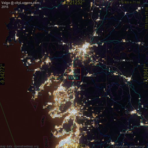
Analysis of Valga night lights 2016
Square area 10x10 km:
 0.61%
0.61%90-99
2.88%80-89
3.48%70-79
4.24%60-69
2.58%50-59
3.48%40-49
2.12%30-39
1.36%20-29
6.36%10-19
34.39%0-9
38.48%Square area 50x50 km:
1.49%90-99
3.24%80-89
1.96%70-79
2.33%60-69
3.27%50-59
3.15%40-49
3.28%30-39
3.92%20-29
7.68%10-19
15.76%0-9
53.93%Clear (daylight) street map image can be seen on geolist.org.
Map coordinates:
43° 12' 45.1" North, 9° 20' 33.8" West
42° 41' 52.5" North, 8° 38' 22.5" West
42° 10' 44.5" North, 7° 56' 11.3" West
Some cities around Valga sort by population:
• Vilagarcía de Arousa
15.2 km =9.4 mi,  222°
222°
• A Estrada
12.4 km =7.7 mi,  94°
94°
• Teo
12.8 km =8 mi,  63°
63°
• Rianxo
15.5 km =9.6 mi,  249°
249°
• Caldas de Reis
10.4 km =6.5 mi,  181°
181°
• Padrón
4.9 km =3 mi,  339°
339°
• Cuntis
9.5 km =5.9 mi,  138°
138°
• Vedra
16 km =9.9 mi, 56°
3106702 (p: 6,143)
Sources (retrieved 2019-11-25):
» Earth at Night: Flat Maps 2012, 2016