Santaella night lights from space
Night Light of Santaella (Andalusia) from space (Spain) Src. Average luminocity for 10x10km area is 3.9416% and for 50x50km: 6.0591%.
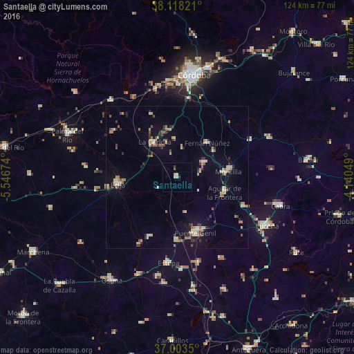
Analysis of Santaella night lights 2016
Square area 10x10 km:
 0%
0%90-99
0.81%80-89
0.65%70-79
1.14%60-69
0.65%50-59
0%40-49
0%30-39
0.65%20-29
0.65%10-19
0.65%0-9
94.81%Square area 50x50 km:
0.43%90-99
0.57%80-89
1.09%70-79
0.86%60-69
1.08%50-59
0.54%40-49
0.56%30-39
1.02%20-29
0.82%10-19
2.55%0-9
90.5%Clear (daylight) street map image can be seen on geolist.org.
Map coordinates:
38° 7' 5.6" North, 5° 32' 48.3" West
37° 33' 46.6" North, 4° 50' 37" West
37° 0' 12.6" North, 4° 8' 25.8" West
Some cities around Santaella sort by population:
• Écija
21.2 km =13.2 mi,  263°
263°
• Puente-Genil
20.4 km =12.7 mi,  160°
160°
• Montilla
18.3 km =11.4 mi,  81°
81°
• Aguilar
17.3 km =10.7 mi,  108°
108°
• La Carlota
14.5 km =9 mi,  327°
327°
• Fernán-Núñez
15.8 km =9.8 mi,  40°
40°
• La Rambla
10.4 km =6.5 mi,  61°
61°
• Herrera
22.1 km =13.7 mi,  181°
181°
2511170 (p: 5,933)
Sources (retrieved 2019-11-25):
» Earth at Night: Flat Maps 2012, 2016