Herrera night lights from space
Night Light of Herrera (Andalusia) from space (Spain) Src. Average luminocity for 10x10km area is 10.125% and for 50x50km: 6.5233%.
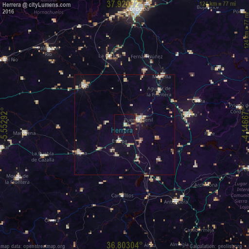
Analysis of Herrera night lights 2016
Square area 10x10 km:
 0.16%
0.16%90-99
0.49%80-89
1.62%70-79
0.81%60-69
2.76%50-59
0.65%40-49
0.32%30-39
1.79%20-29
0.97%10-19
10.23%0-9
80.19%Square area 50x50 km:
0.54%90-99
0.65%80-89
1.31%70-79
0.69%60-69
1.25%50-59
0.44%40-49
0.65%30-39
0.89%20-29
0.64%10-19
2.15%0-9
90.78%Clear (daylight) street map image can be seen on geolist.org.
Map coordinates:
37° 55' 14.6" North, 5° 33' 10.5" West
37° 21' 50.3" North, 4° 50' 59.2" West
36° 48' 10.9" North, 4° 8' 48" West
Some cities around Herrera sort by population:
• Puente-Genil
7.9 km =4.9 mi,  68°
68°
• Osuna
26.4 km =16.4 mi,  237°
237°
• Aguilar
23.9 km =14.9 mi,  45°
45°
• Estepa
8.3 km =5.2 mi,  198°
198°
• Santaella
22.1 km =13.7 mi,  1°
1°
• Casariche
11.1 km =6.9 mi,  134°
134°
• Alameda
24.2 km =15 mi,  135°
135°
• Pedrera
15.8 km =9.8 mi,  194°
194°
2516773 (p: 6,230)
Sources (retrieved 2019-11-25):
» Earth at Night: Flat Maps 2012, 2016