Rojales night lights from space
Night Light of Rojales (Valencia) from space (Spain) Src. Average luminocity for 10x10km area is 56.9773% and for 50x50km: 25.3664%.
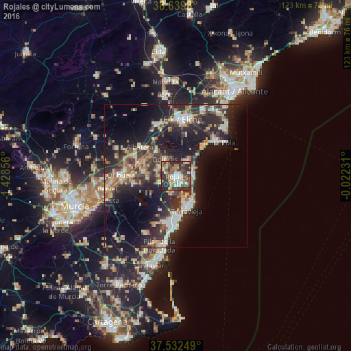
Analysis of Rojales night lights 2016
Square area 10x10 km:
 8.6%
8.6%90-99
9.42%80-89
7.14%70-79
7.63%60-69
8.93%50-59
10.23%40-49
14.29%30-39
16.4%20-29
16.72%10-19
0.65%0-9
0%Square area 50x50 km:
3.13%90-99
4.08%80-89
3.19%70-79
3.3%60-69
3.2%50-59
2.91%40-49
4.17%30-39
5.12%20-29
11%10-19
17.05%0-9
42.85%Clear (daylight) street map image can be seen on geolist.org.
Map coordinates:
38° 38' 21.5" North, 1° 25' 42.8" West
38° 5' 16.8" North, 0° 43' 31.6" West
37° 31' 57" North, 0° 1' 20.3" West
Some cities around Rojales sort by population:
• Torrevieja
12.7 km =7.9 mi,  162°
162°
• Almoradí
6.3 km =3.9 mi,  291°
291°
• Callosa de Segura
14 km =8.7 mi, 287°
• Guardamar del Segura
6.1 km =3.8 mi,  87°
87°
• Dolores
7 km =4.3 mi,  325°
325°
• San Miguel de Salinas
13.3 km =8.3 mi,  204°
204°
• Catral
10.5 km =6.5 mi,  320°
320°
• Benejúzar
10 km =6.2 mi,  263°
263°
2511752 (p: 20,510)
Sources (retrieved 2019-11-25):
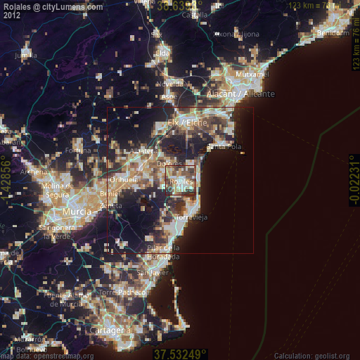
» Earth at Night: Flat Maps 2012, 2016