Torrevieja night lights from space
Night Light of Torrevieja (Valencia) from space (Spain) Src. Average luminocity for 10x10km area is 48.8036% and for 50x50km: 21.2817%.
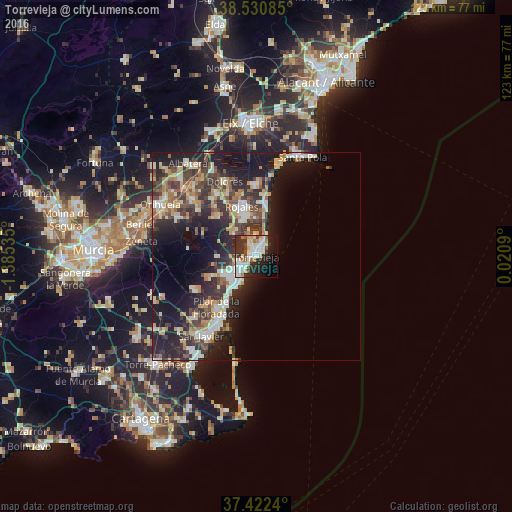
Analysis of Torrevieja night lights 2016
Square area 10x10 km:
 14.61%
90-99
12.01%80-89
4.22%70-79
2.6%60-69
5.52%50-59
2.44%40-49
4.38%30-39
8.93%20-29
16.72%10-19
18.18%0-9
10.39%Square area 50x50 km:
2.9%90-99
3.5%80-89
2.64%70-79
2.78%60-69
2.67%50-59
2.31%40-49
3.54%30-39
4.67%20-29
8.31%10-19
14.04%0-9
52.64%Clear (daylight) street map image can be seen on geolist.org.
Map coordinates:
38° 31' 51.1" North, 1° 23' 7.3" West
37° 58' 43.4" North, 0° 40' 56" West
37° 25' 20.6" North, 0° 1' 15.2" East
Some cities around Torrevieja sort by population:
• San Pedro del Pinatar
18.5 km =11.5 mi,  210°
210°
• Pilar de la Horadada
15.8 km =9.8 mi,  217°
217°
• Rojales
12.7 km =7.9 mi,  342°
342°
• Almoradí
17.4 km =10.8 mi,  326°
326°
• Guardamar del Segura
12.6 km =7.8 mi,  10°
10°
• Dolores
19.5 km =12.1 mi, 336°
• San Miguel de Salinas
9.4 km =5.8 mi,  270°
270°
• Benejúzar
17.6 km =10.9 mi,  308°
308°
2510253 (p: 101,792)
Sources (retrieved 2019-11-25):
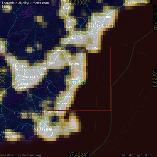
» NASA, Earths city lights 1995
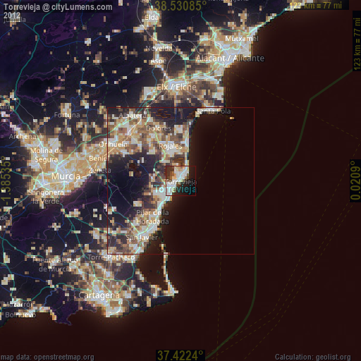
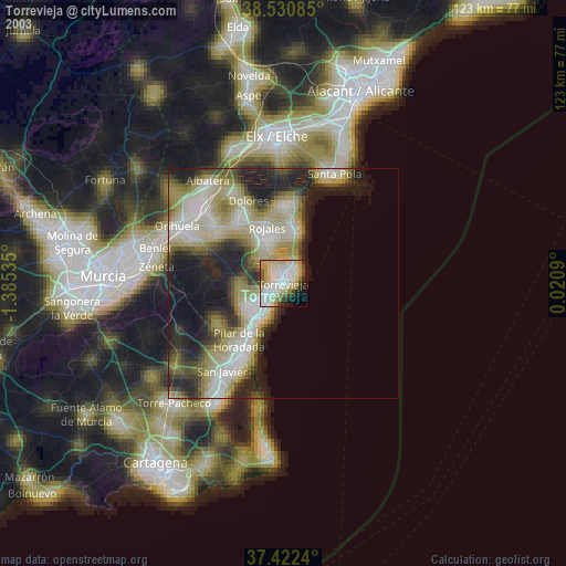
» NASA city lights 2003
» Earth at Night: Flat Maps 2012, 2016