San Miguel de Salinas night lights from space
Night Light of San Miguel de Salinas (Valencia) from space (Spain) Src. Average luminocity for 10x10km area is 29.9367% and for 50x50km: 27.0679%.
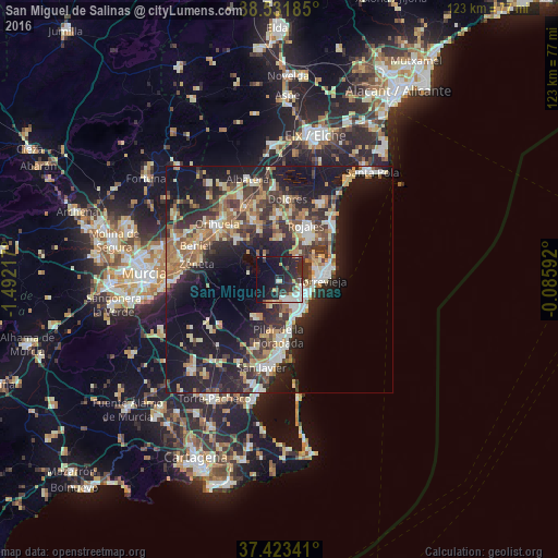
Analysis of San Miguel de Salinas night lights 2016
Square area 10x10 km:
 5.19%
5.19%90-99
5.84%80-89
1.95%70-79
3.73%60-69
0.81%50-59
0.65%40-49
4.22%30-39
5.68%20-29
20.13%10-19
25.65%0-9
26.14%Square area 50x50 km:
3.12%90-99
4.15%80-89
3.48%70-79
3.82%60-69
4.11%50-59
3.31%40-49
4.03%30-39
5.33%20-29
10.43%10-19
19.26%0-9
38.97%Clear (daylight) street map image can be seen on geolist.org.
Map coordinates:
38° 31' 54.7" North, 1° 29' 31.8" West
37° 58' 47" North, 0° 47' 20.5" West
37° 25' 24.3" North, 0° 5' 9.3" West
Some cities around San Miguel de Salinas sort by population:
• Torrevieja
9.4 km =5.8 mi,  90°
90°
• San Pedro del Pinatar
16 km =9.9 mi,  180°
180°
• Pilar de la Horadada
12.7 km =7.9 mi, 181°
• Rojales
13.3 km =8.3 mi,  24°
24°
• Almoradí
14.4 km =8.9 mi,  358°
358°
• Guardamar del Segura
17 km =10.6 mi,  43°
43°
• Bigastro
13.3 km =8.3 mi,  313°
313°
• Benejúzar
11.7 km =7.3 mi,  337°
337°
2511277 (p: 6,281)
Sources (retrieved 2019-11-25):
» Earth at Night: Flat Maps 2012, 2016