Pedralbes night lights from space
Night Light of Pedralbes (Catalonia) from space (Spain) Src. Average luminocity for 10x10km area is 91.5459% and for 50x50km: 42.9298%.
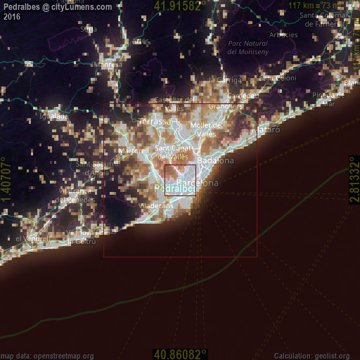
Analysis of Pedralbes night lights 2016
Square area 10x10 km:
 49.49%
90-99
26.36%80-89
2.38%70-79
7.31%60-69
9.69%50-59
4.42%40-49
0.34%30-39
0%20-29
0%10-19
0%0-9
0%Square area 50x50 km:
11.38%90-99
10.14%80-89
4.17%70-79
5.15%60-69
7.5%50-59
5.67%40-49
3.54%30-39
4.02%20-29
7.66%10-19
7.93%0-9
32.85%Clear (daylight) street map image can be seen on geolist.org.
Map coordinates:
41° 54' 57" North, 1° 24' 25.5" East
41° 23' 25.7" North, 2° 6' 36.7" East
40° 51' 39" North, 2° 48' 48" East
Some cities around Pedralbes sort by population:
• Les Corts
1.7 km =1.1 mi,  102°
102°
• Esplugues de Llobregat
2.4 km =1.5 mi,  231°
231°
• Barri de les Corts
2.1 km =1.3 mi, 100°
• La Bonanova
2.5 km =1.6 mi,  47°
47°
• Sarrià
1.4 km =0.9 mi,  20°
20°
• Sants - Badal
2.3 km =1.4 mi,  140°
140°
• la Maternitat i Sant Ramon
1.2 km =0.7 mi,  149°
149°
• Las Tres Torres
1.9 km =1.2 mi,  56°
56°
6545111 (p: 11,800)
Sources (retrieved 2019-11-25):
» Earth at Night: Flat Maps 2012, 2016