Mugardos night lights from space
Night Light of Mugardos (Galicia) from space (Spain) Src. Average luminocity for 10x10km area is 50.4968% and for 50x50km: 19.8316%.
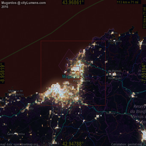
Analysis of Mugardos night lights 2016
Square area 10x10 km:
100  9.21%
9.21%
90-99 11.43%
80-89 4.6%
70-79 3.49%
60-69 7.62%
50-59 10.48%
40-49 10.95%
30-39 5.87%
20-29 12.54%
10-19 22.86%
0-9 0.95%
9.21%90-99
11.43%80-89
4.6%70-79
3.49%60-69
7.62%50-59
10.48%40-49
10.95%30-39
5.87%20-29
12.54%10-19
22.86%0-9
0.95%Square area 50x50 km:
100 2.92%
90-99 3.61%
80-89 1.7%
70-79 2.1%
60-69 3.25%
50-59 3.59%
40-49 3.89%
30-39 3.25%
20-29 7.02%
10-19 8.75%
0-9 59.93%
2.92%90-99
3.61%80-89
1.7%70-79
2.1%60-69
3.25%50-59
3.59%40-49
3.89%30-39
3.25%20-29
7.02%10-19
8.75%0-9
59.93%Clear (daylight) street map image can be seen on geolist.org.
Map coordinates:
43° 58' 7" North, 8° 57' 29.5" West
43° 27' 37.4" North, 8° 15' 18.3" West
42° 56' 52.4" North, 7° 33' 7" West
Some cities around Mugardos sort by population:
• A Coruña
15.1 km =9.4 mi,  228°
228°
• Ferrol
4.3 km =2.7 mi,  41°
41°
• Narón
6.9 km =4.3 mi,  48°
48°
• Oleiros
15 km =9.3 mi,  199°
199°
• Sada
11.6 km =7.2 mi,  181°
181°
• Fene
8.6 km =5.3 mi,  97°
97°
• Ares
3.5 km =2.2 mi,  163°
163°
• Miño
13.1 km =8.1 mi, 160°
3115943 (p: 5,514)
Sources (retrieved 2019-11-25):
» Earth at Night: Flat Maps 2012, 2016