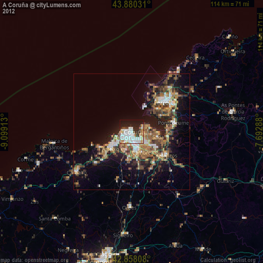
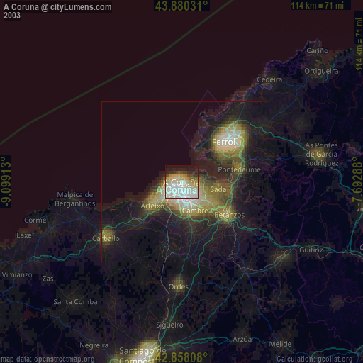
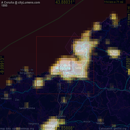
A Coruña night lights from space
Night Light of A Coruña (Galicia) from space (Spain) Src. Average luminocity for 10x10km area is 63.1524% and for 50x50km: 21.2605%.

Analysis of A Coruña night lights 2016
Square area 10x10 km:
 28.57%
90-99
17.94%80-89
1.43%70-79
4.13%60-69
0.95%50-59
3.02%40-49
4.13%30-39
7.46%20-29
15.4%10-19
16.83%0-9
0.16%Square area 50x50 km:
2.94%90-99
3.74%80-89
1.82%70-79
2.18%60-69
3.54%50-59
3.74%40-49
4.05%30-39
3.63%20-29
7.45%10-19
10.44%0-9
56.47%Clear (daylight) street map image can be seen on geolist.org.
Map coordinates:
43° 52' 49.1" North, 9° 5' 56.9" West
43° 22' 16.9" North, 8° 23' 45.6" West
42° 51' 29.1" North, 7° 41' 34.4" West
Some cities around A Coruña sort by population:
• Oleiros
7.7 km =4.8 mi,  123°
123°
• Arteixo
11.7 km =7.3 mi,  230°
230°
• Culleredo
9.3 km =5.8 mi,  176°
176°
• Cambre
9.4 km =5.8 mi,  155°
155°
• Sada
11.3 km =7 mi,  98°
98°
• Bergondo
14.5 km =9 mi,  114°
114°
• Mugardos
15.1 km =9.4 mi,  48°
48°
• Ares
14 km =8.7 mi,  62°
62°
3119841 (p: 246,056)
Sources (retrieved 2019-11-25):
» NASA, Earths city lights 1995
» NASA city lights 2003
» Earth at Night: Flat Maps 2012, 2016