Ferrol night lights from space
Night Light of Ferrol (Galicia) from space (Spain) Src. Average luminocity for 10x10km area is 71.2873% and for 50x50km: 18.028%.
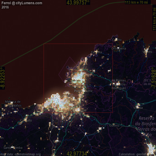
Analysis of Ferrol night lights 2016
Square area 10x10 km:
 16.67%
90-99
20.63%80-89
7.46%70-79
5.71%60-69
9.21%50-59
16.35%40-49
13.81%30-39
5.4%20-29
4.6%10-19
0.16%0-9
0%Square area 50x50 km:
2.92%90-99
3.52%80-89
1.55%70-79
1.92%60-69
2.78%50-59
3.13%40-49
3.32%30-39
2.8%20-29
6.19%10-19
6.79%0-9
65.07%Clear (daylight) street map image can be seen on geolist.org.
Map coordinates:
43° 59' 51.3" North, 8° 55' 21.1" West
43° 29' 22.6" North, 8° 13' 9.8" West
42° 58' 38.4" North, 7° 30' 58.6" West
Some cities around Ferrol sort by population:
• Narón
2.7 km =1.7 mi,  59°
59°
• Oleiros
19.1 km =11.9 mi,  204°
204°
• Sada
15.2 km =9.4 mi,  191°
191°
• Fene
7.1 km =4.4 mi,  128°
128°
• Valdoviño
14.1 km =8.8 mi,  29°
29°
• Mugardos
4.3 km =2.7 mi,  221°
221°
• Ares
6.9 km =4.3 mi, 195°
• Miño
15.6 km =9.7 mi,  174°
174°
3123493 (p: 74,273)
Sources (retrieved 2019-11-25):
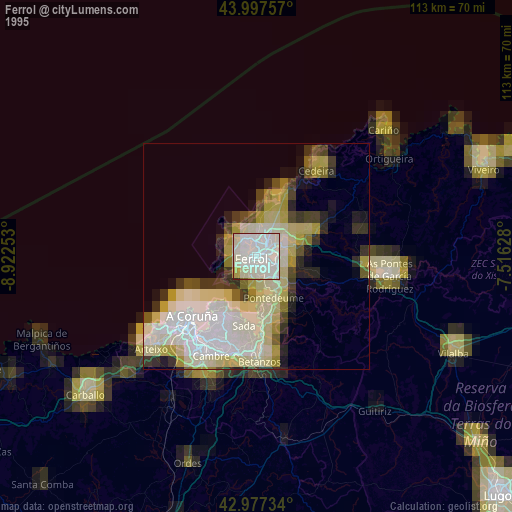
» NASA, Earths city lights 1995
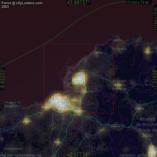
» NASA city lights 2003
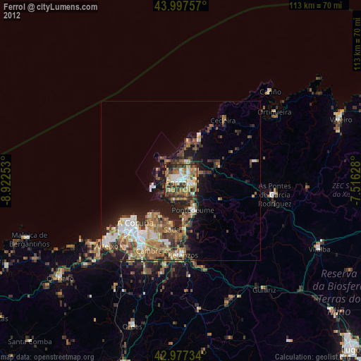
» Earth at Night: Flat Maps 2012, 2016