Moraleja night lights from space
Night Light of Moraleja (Extremadura) from space (Spain) Src. Average luminocity for 10x10km area is 5.7435% and for 50x50km: 1.3613%.
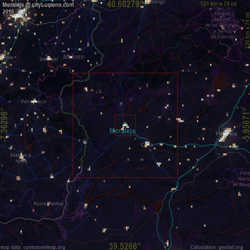
Analysis of Moraleja night lights 2016
Square area 10x10 km:
 0.32%
0.32%90-99
0.97%80-89
1.95%70-79
1.3%60-69
0.32%50-59
0.65%40-49
0.49%30-39
0.16%20-29
0%10-19
0%0-9
93.83%Square area 50x50 km:
0.05%90-99
0.17%80-89
0.46%70-79
0.19%60-69
0.1%50-59
0.07%40-49
0.22%30-39
0.1%20-29
0.48%10-19
0.19%0-9
97.97%Clear (daylight) street map image can be seen on geolist.org.
Map coordinates:
40° 36' 10" North, 7° 21' 46.7" West
40° 4' 0.6" North, 6° 39' 35.4" West
39° 31' 35.8" North, 5° 57' 24.2" West
Some cities around Moraleja sort by population:
• Cáceres
70.1 km =43.6 mi,  159°
159°
• Plasencia
48.8 km =30.3 mi,  94°
94°
• Ciudad Rodrigo
60.2 km =37.4 mi,  10°
10°
• Coria
14 km =8.7 mi,  131°
131°
• Fundão, PT
72 km =44.7 mi,  276°
276°
• Arroyo de la Luz
65 km =40.4 mi,  174°
174°
• Montehermoso
26.5 km =16.5 mi,  84°
84°
• Alcains, PT
69.9 km =43.4 mi,  256°
256°
3116198 (p: 7,995)
Sources (retrieved 2019-11-25):
» Earth at Night: Flat Maps 2012, 2016