León night lights from space
Night Light of León (Castille and León) from space (Spain) Src. Average luminocity for 10x10km area is 67.3697% and for 50x50km: 8.8132%.
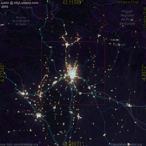

Analysis of León night lights 2016
Square area 10x10 km:
 19.7%
19.7%90-99
22.42%80-89
6.36%70-79
5%60-69
5.91%50-59
6.97%40-49
2.73%30-39
12.12%20-29
12.27%10-19
6.52%0-9
0%Square area 50x50 km:
1.08%90-99
1.66%80-89
0.89%70-79
0.82%60-69
0.94%50-59
1.05%40-49
1.09%30-39
1.67%20-29
2.74%10-19
4.38%0-9
83.67%Clear (daylight) street map image can be seen on geolist.org.
Map coordinates:
43° 6' 55.6" North, 6° 16' 24.4" West
42° 36' 0.1" North, 5° 34' 13.2" West
42° 4' 49.1" North, 4° 52' 1.9" West
Some cities around León sort by population:
• San Andrés del Rabanedo
4 km =2.5 mi,  288°
288°
• Benavente
67 km =41.6 mi,  187°
187°
• Villaquilambre
5.3 km =3.3 mi,  10°
10°
• Pola de Lena
65.8 km =40.9 mi,  341°
341°
• Ruayer
50.5 km =31.4 mi,  1°
1°
• Astorga
42.8 km =26.6 mi,  248°
248°
• La Bañeza
42.8 km =26.6 mi,  218°
218°
• Guardo
62.7 km =39 mi,  70°
70°
3118532 (p: 134,305)
Sources (retrieved 2019-11-25):
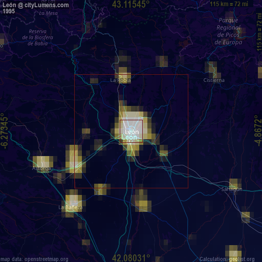
» NASA, Earths city lights 1995
» NASA city lights 2003
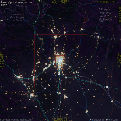
» Earth at Night: Flat Maps 2012, 2016