Leganés night lights from space
Night Light of Leganés (Madrid) from space (Spain) Src. Average luminocity for 10x10km area is 95.898% and for 50x50km: 53.8153%.
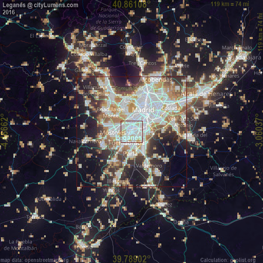
Analysis of Leganés night lights 2016
Square area 10x10 km:
 44.9%
44.9%90-99
37.41%80-89
11.56%70-79
6.12%60-69
0%50-59
0%40-49
0%30-39
0%20-29
0%10-19
0%0-9
0%Square area 50x50 km:
15.48%90-99
13.72%80-89
4.93%70-79
6.16%60-69
6.09%50-59
5.44%40-49
5.08%30-39
6.27%20-29
10.2%10-19
13.54%0-9
13.08%Clear (daylight) street map image can be seen on geolist.org.
Map coordinates:
40° 51' 39.9" North, 4° 27' 59.8" West
40° 19' 37.8" North, 3° 45' 48.6" West
39° 47' 20.5" North, 3° 3' 37.3" West
Some cities around Leganés sort by population:
• Latina
7 km =4.3 mi,  12°
12°
• Carabanchel
7.8 km =4.8 mi,  25°
25°
• Móstoles
8.6 km =5.3 mi,  266°
266°
• Fuenlabrada
5.4 km =3.4 mi,  208°
208°
• Alcorcón
5.6 km =3.5 mi,  291°
291°
• Getafe
3.5 km =2.2 mi,  132°
132°
• Usera
8.7 km =5.4 mi,  38°
38°
• Villaverde
5.9 km =3.7 mi,  64°
64°
3118594 (p: 186,066)
Sources (retrieved 2019-11-25):
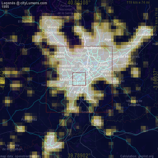
» NASA, Earths city lights 1995
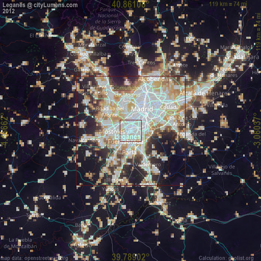
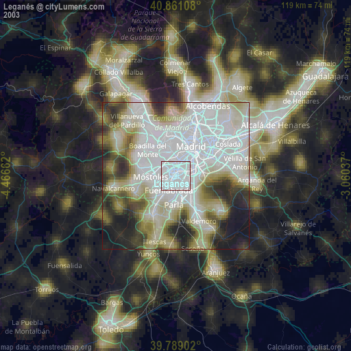
» NASA city lights 2003
» Earth at Night: Flat Maps 2012, 2016