Alcorcón night lights from space
Night Light of Alcorcón (Madrid) from space (Spain) Src. Average luminocity for 10x10km area is 90% and for 50x50km: 51.0691%.
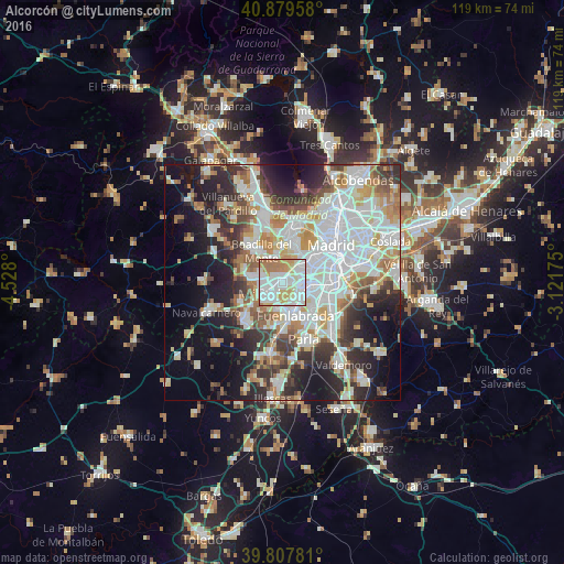
Analysis of Alcorcón night lights 2016
Square area 10x10 km:
 32.82%
90-99
32.65%80-89
10.88%70-79
10.37%60-69
12.07%50-59
1.19%40-49
0%30-39
0%20-29
0%10-19
0%0-9
0%Square area 50x50 km:
14.91%90-99
12.94%80-89
4.73%70-79
5.73%60-69
5.65%50-59
4.65%40-49
4.46%30-39
6.01%20-29
9.83%10-19
13.92%0-9
17.17%Clear (daylight) street map image can be seen on geolist.org.
Map coordinates:
40° 52' 46.5" North, 4° 31' 40.8" West
40° 20' 45" North, 3° 49' 29.5" West
39° 48' 28.1" North, 3° 7' 18.3" West
Some cities around Alcorcón sort by population:
• Latina
8.2 km =5.1 mi,  54°
54°
• Móstoles
4.3 km =2.7 mi,  232°
232°
• Fuenlabrada
7.3 km =4.5 mi,  159°
159°
• Leganés
5.6 km =3.5 mi,  111°
111°
• Getafe
9 km =5.6 mi,  119°
119°
• Pozuelo de Alarcón
9.7 km =6 mi,  5°
5°
• Boadilla del Monte
8 km =5 mi,  325°
325°
• Villaviciosa de Odón
6.9 km =4.3 mi,  281°
281°
3130564 (p: 167,967)
Sources (retrieved 2019-11-25):
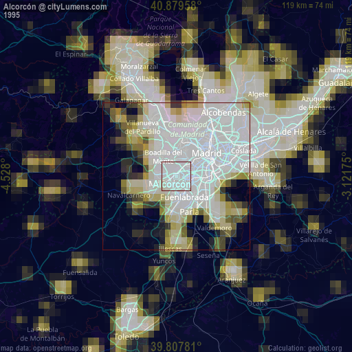
» NASA, Earths city lights 1995
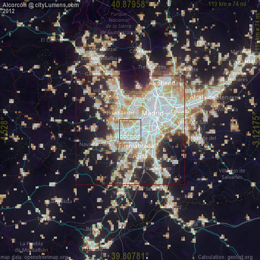
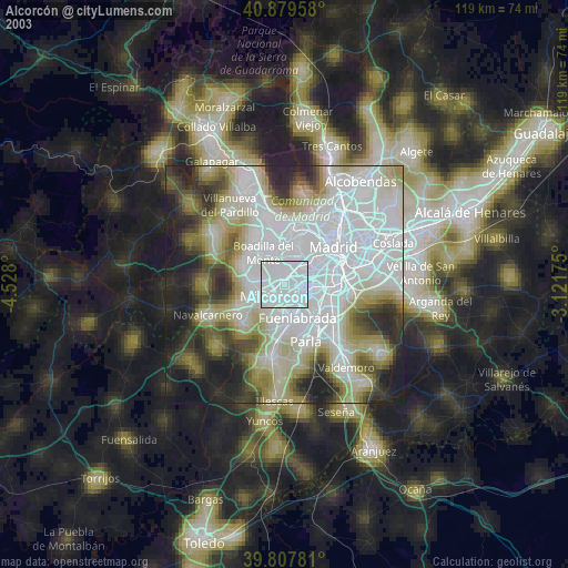
» NASA city lights 2003
» Earth at Night: Flat Maps 2012, 2016