Getafe night lights from space
Night Light of Getafe (Madrid) from space (Spain) Src. Average luminocity for 10x10km area is 95.4048% and for 50x50km: 53.5312%.
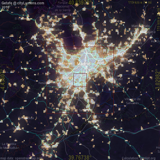
Analysis of Getafe night lights 2016
Square area 10x10 km:
 45.24%
90-99
38.61%80-89
5.61%70-79
8.16%60-69
1.7%50-59
0.68%40-49
0%30-39
0%20-29
0%10-19
0%0-9
0%Square area 50x50 km:
15.41%90-99
13.57%80-89
4.88%70-79
6.32%60-69
6.04%50-59
5.46%40-49
4.94%30-39
6.25%20-29
10.39%10-19
13.34%0-9
13.41%Clear (daylight) street map image can be seen on geolist.org.
Map coordinates:
40° 50' 23.2" North, 4° 26' 9.9" West
40° 18' 20.6" North, 3° 43' 58.6" West
39° 46' 2.6" North, 3° 1' 47.4" West
Some cities around Getafe sort by population:
• Latina
9.3 km =5.8 mi,  353°
353°
• Carabanchel
9.5 km =5.9 mi,  4°
4°
• Fuenlabrada
5.7 km =3.5 mi,  245°
245°
• Leganés
3.5 km =2.2 mi,  312°
312°
• Alcorcón
9 km =5.6 mi,  299°
299°
• Villaverde
5.7 km =3.5 mi,  29°
29°
• Parla
8.3 km =5.2 mi,  200°
200°
• Pinto
7.7 km =4.8 mi,  158°
158°
3121437 (p: 167,164)
Sources (retrieved 2019-11-25):
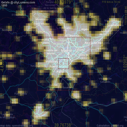
» NASA, Earths city lights 1995
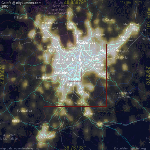
» NASA city lights 2003
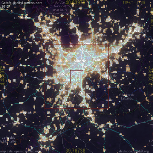
» Earth at Night: Flat Maps 2012, 2016