Usera night lights from space
Night Light of Usera (Madrid) from space (Spain) Src. Average luminocity for 10x10km area is 97.5459% and for 50x50km: 56.3757%.
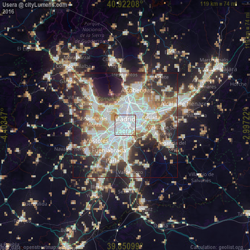
Analysis of Usera night lights 2016
Square area 10x10 km:
 65.65%
90-99
25%80-89
3.57%70-79
5.27%60-69
0.51%50-59
0%40-49
0%30-39
0%20-29
0%10-19
0%0-9
0%Square area 50x50 km:
15.95%90-99
14.24%80-89
5.09%70-79
6.59%60-69
6.58%50-59
5.96%40-49
5.69%30-39
7.67%20-29
11.55%10-19
10.83%0-9
9.85%Clear (daylight) street map image can be seen on geolist.org.
Map coordinates:
40° 55' 19.5" North, 4° 24' 12.5" West
40° 23' 19.2" North, 3° 42' 1.3" West
39° 51' 3.6" North, 2° 59' 50" West
Some cities around Usera sort by population:
• Madrid
3.1 km =1.9 mi,  356°
356°
• Latina
3.8 km =2.4 mi,  270°
270°
• Carabanchel
2 km =1.2 mi,  277°
277°
• Puente de Vallecas
3.3 km =2.1 mi,  80°
80°
• City Center
3.3 km =2.1 mi, 356°
• Arganzuela
1.3 km =0.8 mi,  15°
15°
• Villaverde
4.3 km =2.7 mi,  179°
179°
• Retiro
3.1 km =1.9 mi,  28°
28°
6544490 (p: 141,189)
Sources (retrieved 2019-11-25):
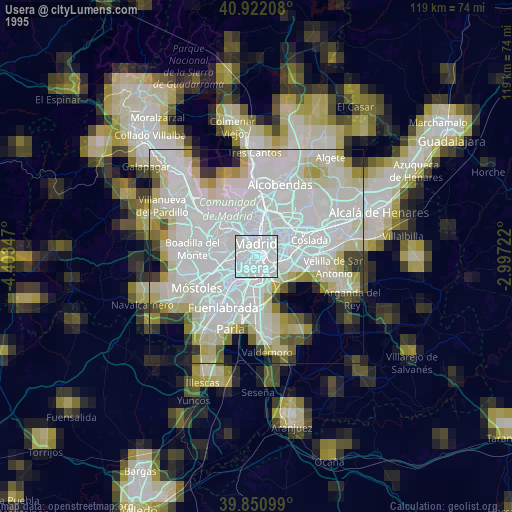
» NASA, Earths city lights 1995
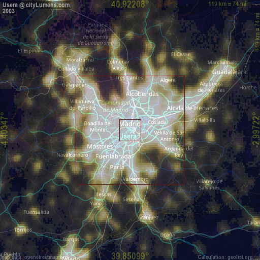
» NASA city lights 2003
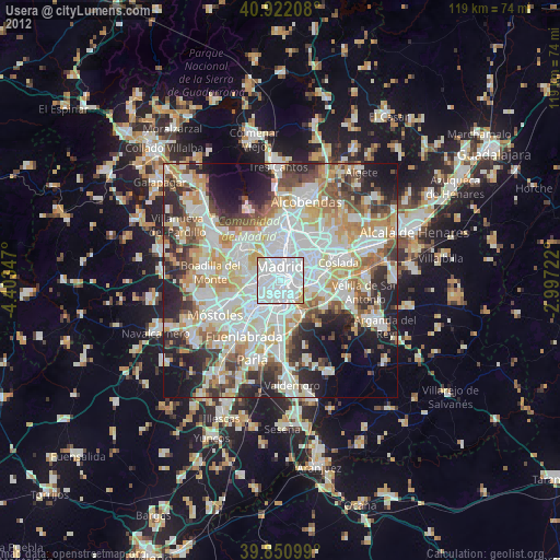
» Earth at Night: Flat Maps 2012, 2016