Fuenlabrada night lights from space
Night Light of Fuenlabrada (Madrid) from space (Spain) Src. Average luminocity for 10x10km area is 88.5119% and for 50x50km: 49.4948%.
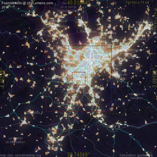
Analysis of Fuenlabrada night lights 2016
Square area 10x10 km:
 31.8%
31.8%90-99
32.48%80-89
9.35%70-79
9.86%60-69
9.69%50-59
4.08%40-49
2.55%30-39
0.17%20-29
0%10-19
0%0-9
0%Square area 50x50 km:
14.4%90-99
12.27%80-89
4.68%70-79
5.77%60-69
5.56%50-59
4.74%40-49
3.9%30-39
5.22%20-29
9.14%10-19
15.59%0-9
18.74%Clear (daylight) street map image can be seen on geolist.org.
Map coordinates:
40° 49' 6.4" North, 4° 29' 50.2" West
40° 17' 3.1" North, 3° 47' 38.9" West
39° 44' 44.5" North, 3° 5' 27.7" West
Some cities around Fuenlabrada sort by population:
• Móstoles
7.4 km =4.6 mi,  305°
305°
• Leganés
5.4 km =3.4 mi,  28°
28°
• Alcorcón
7.3 km =4.5 mi,  339°
339°
• Getafe
5.7 km =3.5 mi,  65°
65°
• Parla
5.8 km =3.6 mi,  157°
157°
• Pinto
9.3 km =5.8 mi,  120°
120°
• Humanes de Madrid
4.9 km =3 mi,  219°
219°
• Torrejón de la Calzada
9.5 km =5.9 mi,  181°
181°
3121960 (p: 197,836)
Sources (retrieved 2019-11-25):
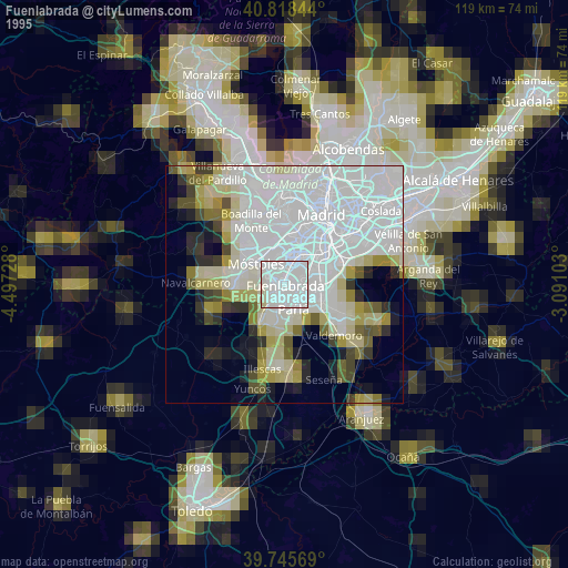
» NASA, Earths city lights 1995
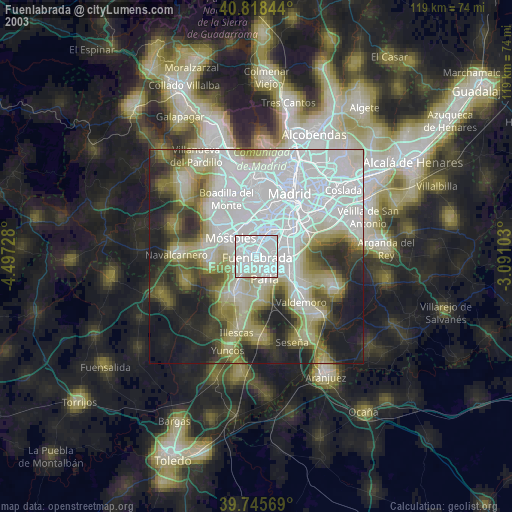
» NASA city lights 2003
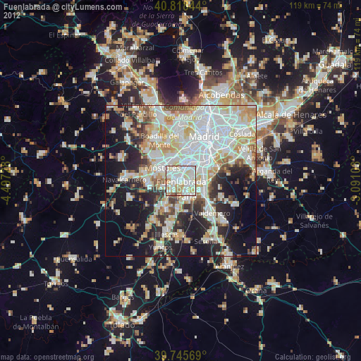
» Earth at Night: Flat Maps 2012, 2016