Latina night lights from space
Night Light of Latina (Madrid) from space (Spain) Src. Average luminocity for 10x10km area is 95.9864% and for 50x50km: 56.0134%.
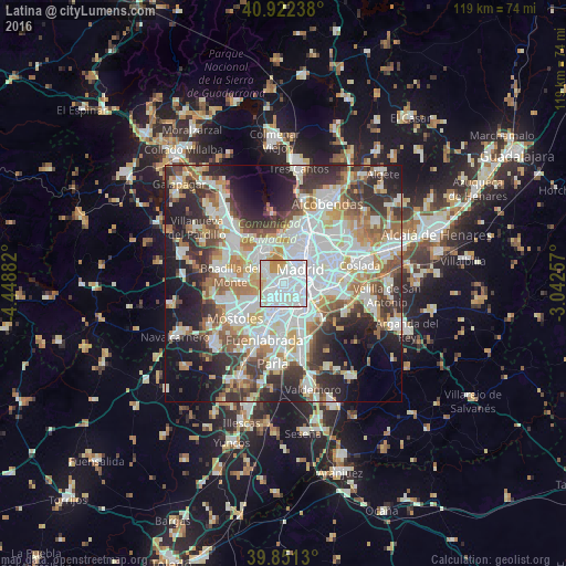
Analysis of Latina night lights 2016
Square area 10x10 km:
 53.4%
53.4%90-99
30.78%80-89
5.61%70-79
9.86%60-69
0.34%50-59
0%40-49
0%30-39
0%20-29
0%10-19
0%0-9
0%Square area 50x50 km:
15.95%90-99
14.13%80-89
5.05%70-79
6.48%60-69
6.47%50-59
5.85%40-49
5.52%30-39
7.41%20-29
11.2%10-19
12.3%0-9
9.64%Clear (daylight) street map image can be seen on geolist.org.
Map coordinates:
40° 55' 20.6" North, 4° 26' 55.8" West
40° 23' 20.3" North, 3° 44' 44.5" West
39° 51' 4.7" North, 3° 2' 33.3" West
Some cities around Latina sort by population:
• Madrid
4.8 km =3 mi,  50°
50°
• Carabanchel
1.8 km =1.1 mi,  83°
83°
• City Center
4.9 km =3 mi, 48°
• Arganzuela
4.4 km =2.7 mi,  73°
73°
• Usera
3.8 km =2.4 mi,  90°
90°
• Villaverde
5.8 km =3.6 mi,  138°
138°
• Retiro
5.9 km =3.7 mi,  63°
63°
• Moncloa-Aravaca
5.3 km =3.3 mi,  12°
12°
6544489 (p: 256,644)
Sources (retrieved 2019-11-25):
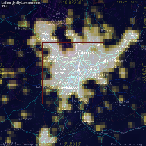
» NASA, Earths city lights 1995
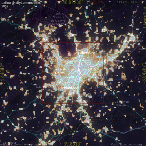
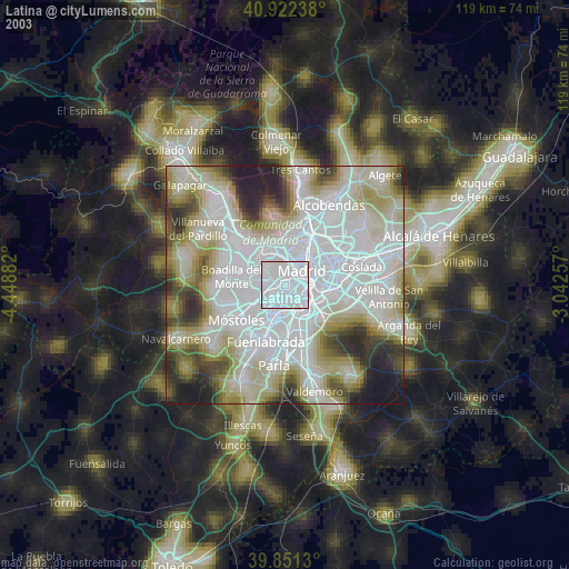
» NASA city lights 2003
» Earth at Night: Flat Maps 2012, 2016