la Vila Olímpica del Poblenou night lights from space
Night Light of la Vila Olímpica del Poblenou (Catalonia) from space (Spain) Src. Average luminocity for 10x10km area is 75.7602% and for 50x50km: 40.5615%.
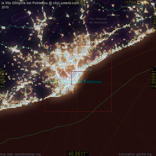
Analysis of la Vila Olímpica del Poblenou night lights 2016
Square area 10x10 km:
 44.9%
44.9%90-99
18.03%80-89
0.68%70-79
0%60-69
0.17%50-59
10.03%40-49
5.95%30-39
5.1%20-29
6.97%10-19
6.46%0-9
1.7%Square area 50x50 km:
11.24%90-99
9.99%80-89
3.75%70-79
4.78%60-69
7.24%50-59
5.15%40-49
3.23%30-39
3.63%20-29
6.47%10-19
6%0-9
38.53%Clear (daylight) street map image can be seen on geolist.org.
Map coordinates:
41° 54' 58" North, 1° 29' 37.2" East
41° 23' 26.7" North, 2° 11' 48.4" East
40° 51' 40" North, 2° 53' 59.7" East
Some cities around la Vila Olímpica del Poblenou sort by population:
• el Poblenou
1.6 km =1 mi,  22°
22°
• Fort Pienc
1.5 km =0.9 mi,  286°
286°
• el Clot
2.2 km =1.4 mi,  346°
346°
• Sant Pere, Santa Caterina i La Ribera
1.5 km =0.9 mi,  241°
241°
• Provenals del Poblenou
2.3 km =1.4 mi,  12°
12°
• Barri Gòtic
1.9 km =1.2 mi,  245°
245°
• la Barceloneta
1.3 km =0.8 mi,  206°
206°
• el Parc i la Llacuna del Poblenou
1 km =0.6 mi,  328°
328°
11549810 (p: 9,379)
Sources (retrieved 2019-11-25):
» Earth at Night: Flat Maps 2012, 2016