el Clot night lights from space
Night Light of el Clot (Catalonia) from space (Spain) Src. Average luminocity for 10x10km area is 85.4048% and for 50x50km: 42.5408%.
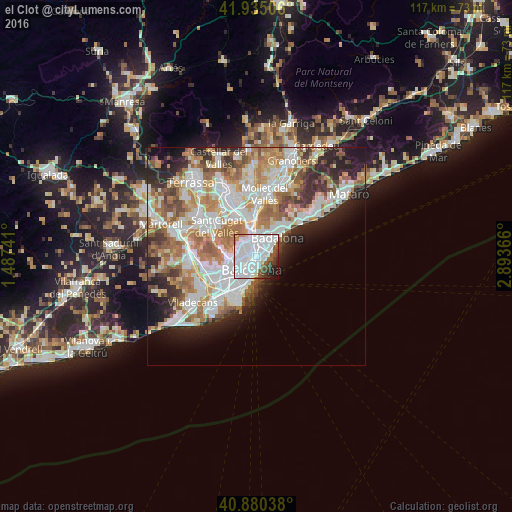
Analysis of el Clot night lights 2016
Square area 10x10 km:
 52.89%
90-99
21.43%80-89
1.02%70-79
1.53%60-69
1.19%50-59
8.33%40-49
4.08%30-39
3.57%20-29
3.57%10-19
2.38%0-9
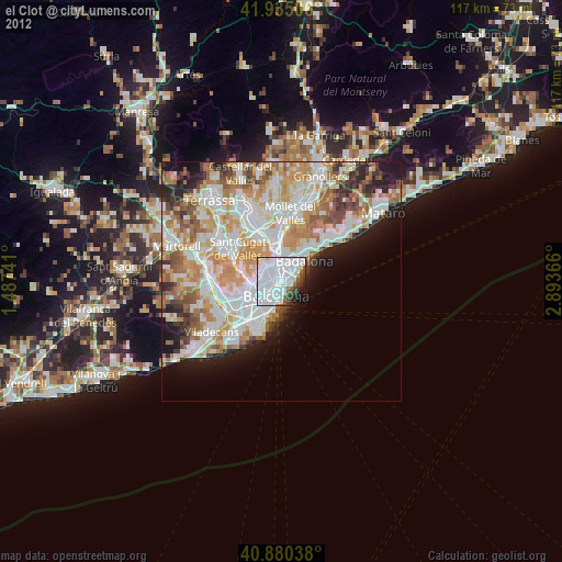
0%Square area 50x50 km:
11.44%90-99
10.36%80-89
4.02%70-79
5.08%60-69
7.71%50-59
5.47%40-49
3.47%30-39
3.92%20-29
7.15%10-19
6.65%0-9
34.72%Clear (daylight) street map image can be seen on geolist.org.
Map coordinates:
41° 56' 6.2" North, 1° 29' 14.7" East
41° 24' 35.5" North, 2° 11' 25.9" East
40° 52' 49.4" North, 2° 53' 37.2" East
Some cities around el Clot sort by population:
• Sant Martí
1.2 km =0.7 mi,  38°
38°
• el Camp de l'Arpa del Clot
0.7 km =0.4 mi,  289°
289°
• el Poblenou
1.3 km =0.8 mi,  120°
120°
• La Sagrera
1.5 km =0.9 mi,  344°
344°
• Sant Martí de Provençals
1.2 km =0.7 mi,  22°
22°
• Navas
1 km =0.6 mi, 337°
• Provenals del Poblenou
1 km =0.6 mi,  82°
82°
• el Parc i la Llacuna del Poblenou
1.3 km =0.8 mi,  180°
180°
3124932 (p: 27,170)
Sources (retrieved 2019-11-25):
» Earth at Night: Flat Maps 2012, 2016