la Marina de Port night lights from space
Night Light of la Marina de Port (Catalonia) from space (Spain) Src. Average luminocity for 10x10km area is 90.9439% and for 50x50km: 38.8408%.
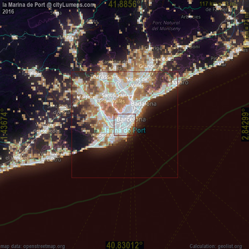
Analysis of la Marina de Port night lights 2016
Square area 10x10 km:
 54.93%
90-99
27.21%80-89
1.36%70-79
2.04%60-69
1.19%50-59
5.61%40-49
3.57%30-39
2.55%20-29
1.36%10-19
0.17%0-9
0%Square area 50x50 km:
11.09%90-99
9.55%80-89
3.47%70-79
4.65%60-69
6.61%50-59
4.85%40-49
2.88%30-39
3.41%20-29
5.95%10-19
5.96%0-9
41.58%Clear (daylight) street map image can be seen on geolist.org.
Map coordinates:
41° 53' 8.2" North, 1° 26' 12.3" East
41° 21' 36" North, 2° 8' 23.5" East
40° 49' 48.4" North, 2° 50' 34.8" East
Some cities around la Marina de Port sort by population:
• Sants-Montjuïc
1.9 km =1.2 mi,  41°
41°
• Sants
1.6 km =1 mi,  355°
355°
• Poble Sec
2.5 km =1.6 mi,  50°
50°
• Sant Antoni
2.6 km =1.6 mi, 38°
• Sants - Badal
1.9 km =1.2 mi,  328°
328°
• La Bordeta
1.6 km =1 mi,  11°
11°
• Hostafrancs
1.9 km =1.2 mi, 8°
• la Font de la Guatlla
1.2 km =0.7 mi,  20°
20°
11549793 (p: 30,479)
Sources (retrieved 2019-11-25):
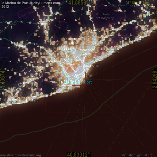
» Earth at Night: Flat Maps 2012, 2016