L'Hospitalet de Llobregat night lights from space
Night Light of L'Hospitalet de Llobregat (Catalonia) from space (Spain) Src. Average luminocity for 10x10km area is 95.8044% and for 50x50km: 39.4316%.
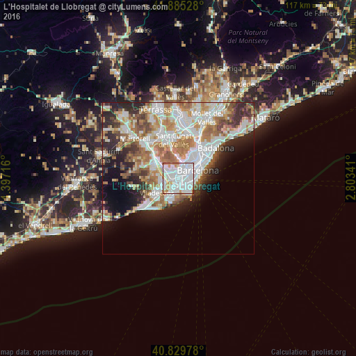
Analysis of L'Hospitalet de Llobregat night lights 2016
Square area 10x10 km:
 54.93%
90-99
31.12%80-89
2.21%70-79
9.18%60-69
2.21%50-59
0.34%40-49
0%30-39
0%20-29
0%10-19
0%0-9
0%Square area 50x50 km:
10.92%90-99
9.51%80-89
3.67%70-79
4.76%60-69
6.74%50-59
4.81%40-49
2.98%30-39
3.51%20-29
6.68%10-19
7.31%0-9
39.11%Clear (daylight) street map image can be seen on geolist.org.
Map coordinates:
41° 53' 7" North, 1° 23' 49.8" East
41° 21' 34.8" North, 2° 6' 1" East
40° 49' 47.2" North, 2° 48' 12.3" East
Some cities around L'Hospitalet de Llobregat sort by population:
• Cornellà de Llobregat
1.8 km =1.1 mi,  232°
232°
• El Prat de Llobregat
3.6 km =2.2 mi,  187°
187°
• Esplugues de Llobregat
2.2 km =1.4 mi,  332°
332°
• Sants
3.6 km =2.2 mi,  62°
62°
• la Marina de Port
3.3 km =2.1 mi,  89°
89°
• Sants - Badal
2.8 km =1.7 mi,  53°
53°
• la Maternitat i Sant Ramon
2.8 km =1.7 mi,  30°
30°
• Pedralbes
3.5 km =2.2 mi,  13°
13°
3120619 (p: 257,038)
Sources (retrieved 2019-11-25):
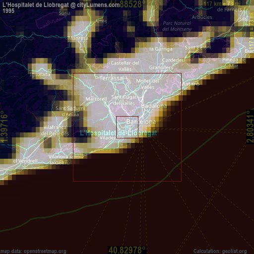
» NASA, Earths city lights 1995
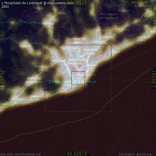
» NASA city lights 2003
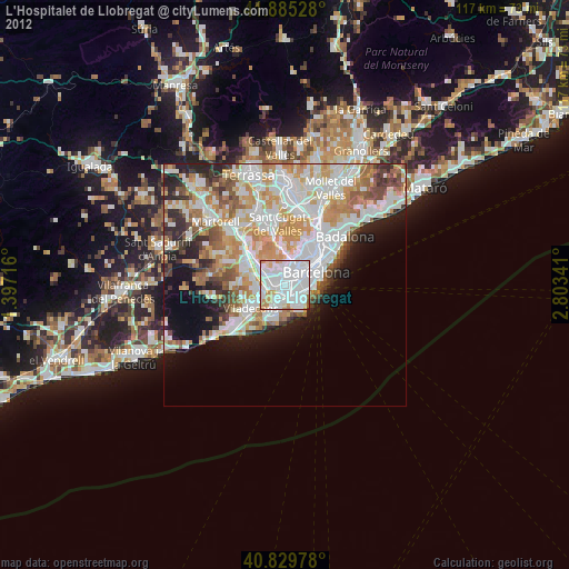
» Earth at Night: Flat Maps 2012, 2016