Valdoviño night lights from space
Night Light of Valdoviño (Galicia) from space (Spain) Src. Average luminocity for 10x10km area is 19.3894% and for 50x50km: 8.7706%.
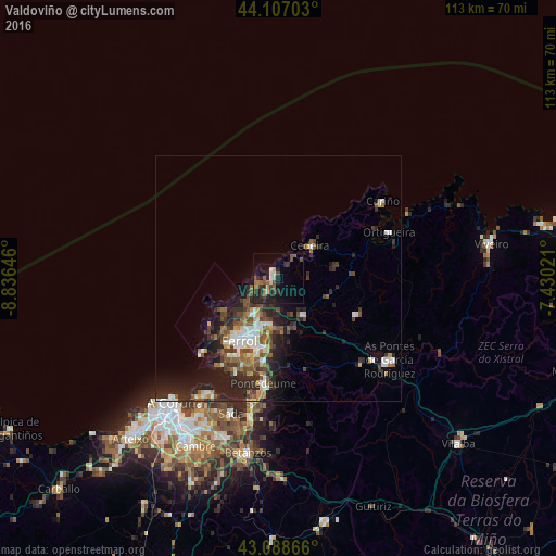
Analysis of Valdoviño night lights 2016
Square area 10x10 km:
 0%
0%90-99
2.12%80-89
2.73%70-79
1.21%60-69
3.18%50-59
3.79%40-49
4.85%30-39
2.88%20-29
10.91%10-19
14.24%0-9
54.09%Square area 50x50 km:
1.04%90-99
1.44%80-89
0.7%70-79
0.7%60-69
1.07%50-59
1.59%40-49
1.81%30-39
1.64%20-29
4.08%10-19
5.14%0-9
80.78%Clear (daylight) street map image can be seen on geolist.org.
Map coordinates:
44° 6' 25.3" North, 8° 50' 11.3" West
43° 36' 0" North, 8° 7' 60" West
43° 5' 19.2" North, 7° 25' 48.8" West
Some cities around Valdoviño sort by population:
• Ferrol
14.1 km =8.8 mi,  209°
209°
• Narón
11.9 km =7.4 mi,  202°
202°
• Fene
16.7 km =10.4 mi,  184°
184°
• As Pontes de García Rodríguez
28 km =17.4 mi,  125°
125°
• Santa Marta de Ortigueira
24.6 km =15.3 mi,  67°
67°
• Cedeira
9.1 km =5.7 mi,  42°
42°
• Mugardos
18.4 km =11.4 mi, 212°
• Ares
20.9 km =13 mi, 204°
3106732 (p: 6,838)
Sources (retrieved 2019-11-25):
» Earth at Night: Flat Maps 2012, 2016